After the Lagoon
蒼海蚵田——消失潟湖與廢棄魚塭的產業地景重構轉譯
Landscape Regeneration and Translation of Vanishing Lagoons and Abandoned Aquacultures
- Site
- Dongshi Township, Chiayi County, Taiwan
- Year
- 2026
- Type
- Graduation design studio
- Role
- Individual work
- Advisor
- Prof. Yu Feng Wang
- Site area
- 302 ha
- Award
- Honorable Mention, 20th National Student Landscape Design Competition
Taiwan's largest oyster coast is losing its lagoon.
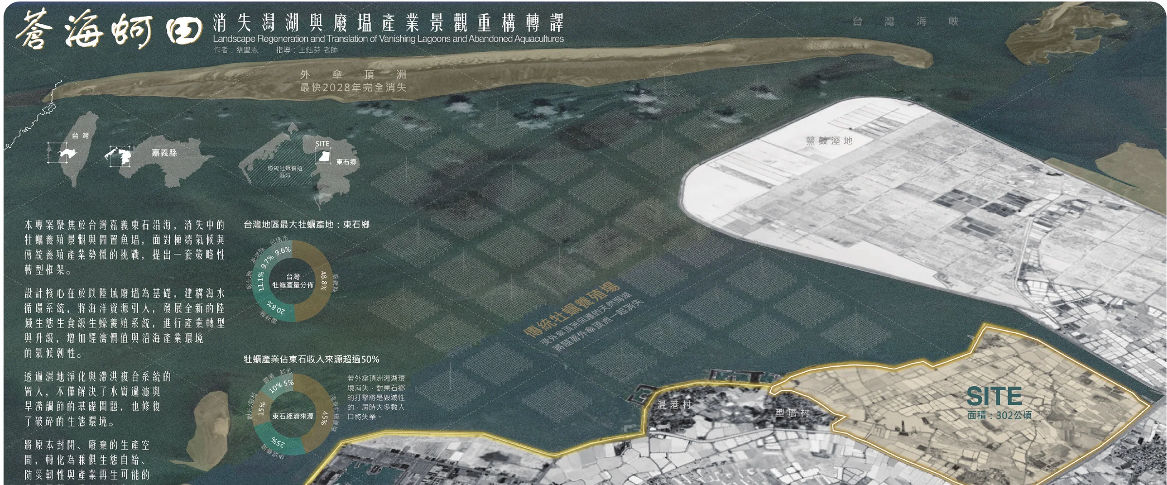
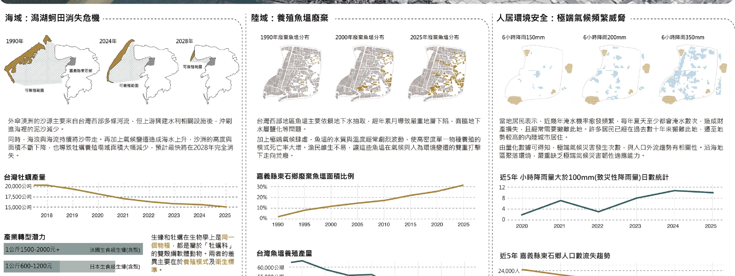
Dongshi produces nearly half of Taiwan’s oysters, raised on racks in the shallow lagoon behind the Waisanding sandbar. Cut off from its sediment supply, the sandbar keeps shrinking and is projected to disappear by 2028. When it goes, the lagoon and most of the town’s livelihood go with it.
On land, decades of groundwater pumping for fishponds caused subsidence and salinization. Wild swings in water quality and temperature now kill dense single-species stock, and the share of abandoned ponds in Dongshi has climbed from almost none in 1990 to around 30% today.
The villages are caught in between. The low ground floods at least once or twice every summer, days of rain above 100 mm an hour have become more frequent over the past five years, and families have been moving inland for decades.

Same species, a twentieth of the price.
Taiwanese lagoon oysters sell for NT$50–100 per kilogram. Raw-grade oysters from France sell for NT$1,500–2,000. The difference is the farming environment: high-value oysters grow in controlled seawater ponds and pass through finishing and depuration before sale. Lagoon racks offer no such control, and stock dies when conditions change.
The project asks whether Dongshi’s abandoned fishponds could become that controlled environment, and whether the same ground could also protect the villages from flooding.
Two linked systems on the abandoned ponds.
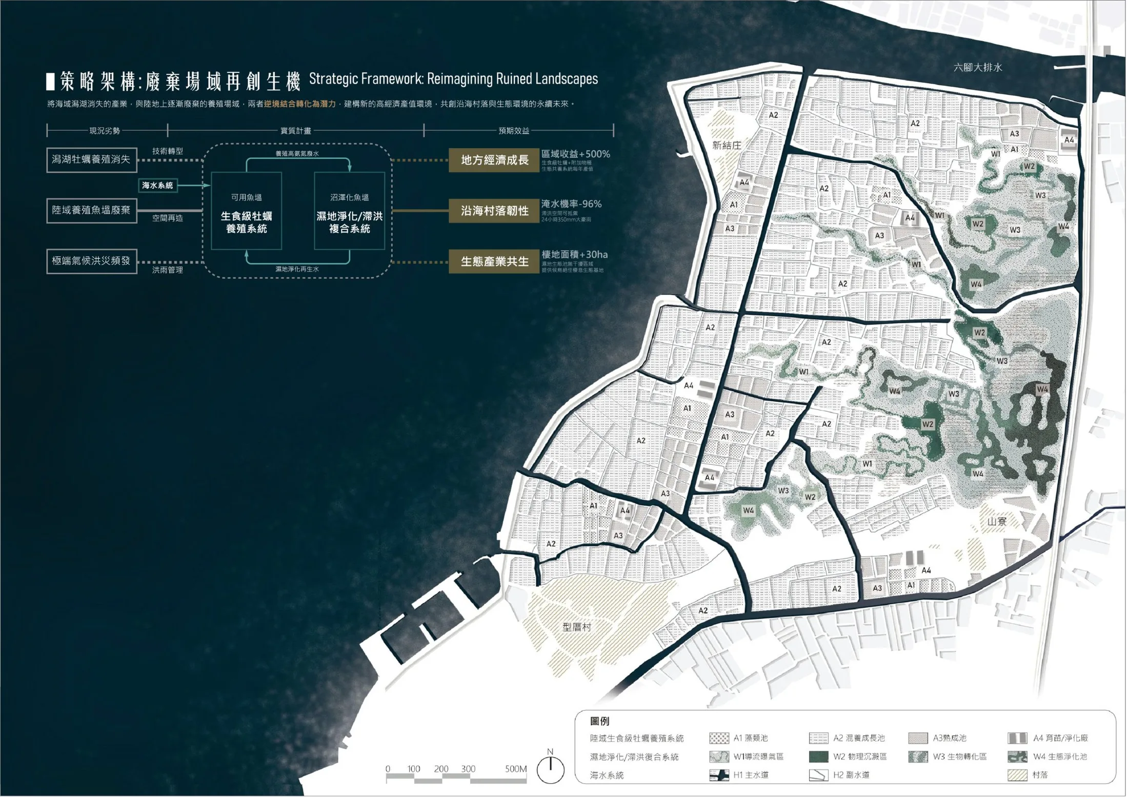
Usable ponds are converted into a land-based, raw-grade oyster farm. Ponds that have already turned to marsh, about 60 hectares, become a wetland that cleans the farm’s nutrient-rich effluent and holds stormwater. Treated water returns to the farm, so the two systems feed each other.
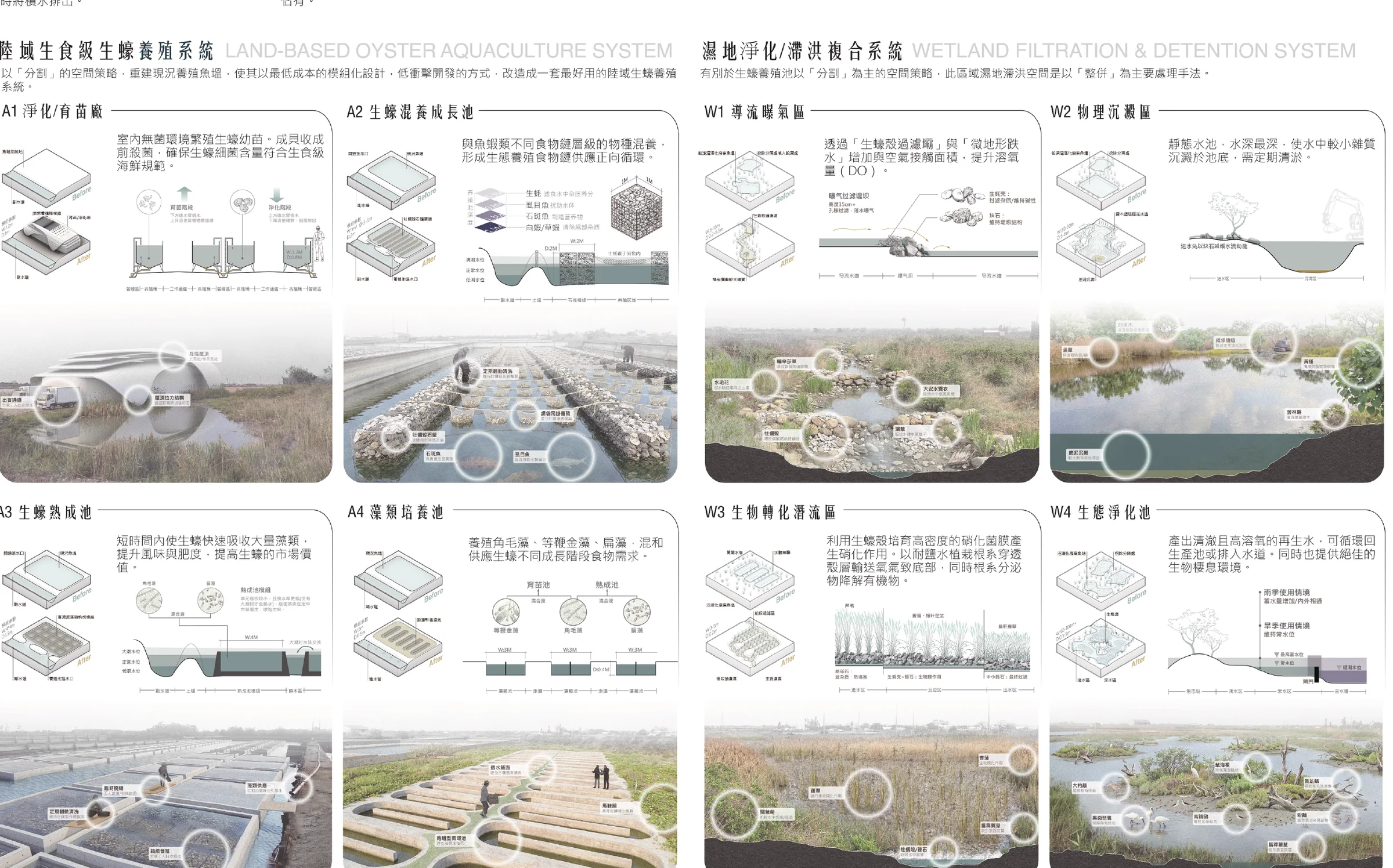
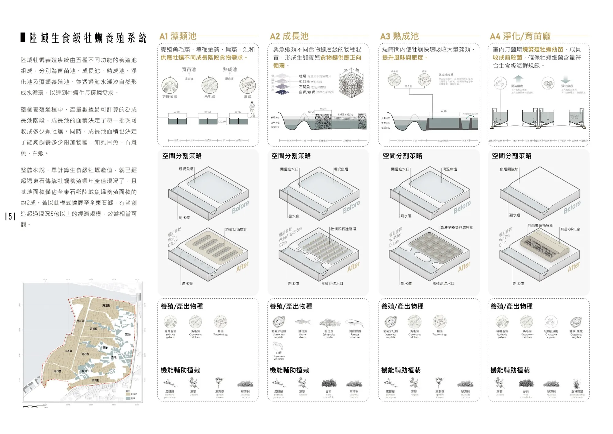
Oyster aquaculture system
A1Algae ponds grow feed microalgae for each growth stageA2Grow-out ponds mixed with milkfish, grouper and shrimp to close the food chainA3Finishing ponds fatten oysters on dense algae before harvestA4Nursery and depuration hall for sterile spat and pre-sale cleaning
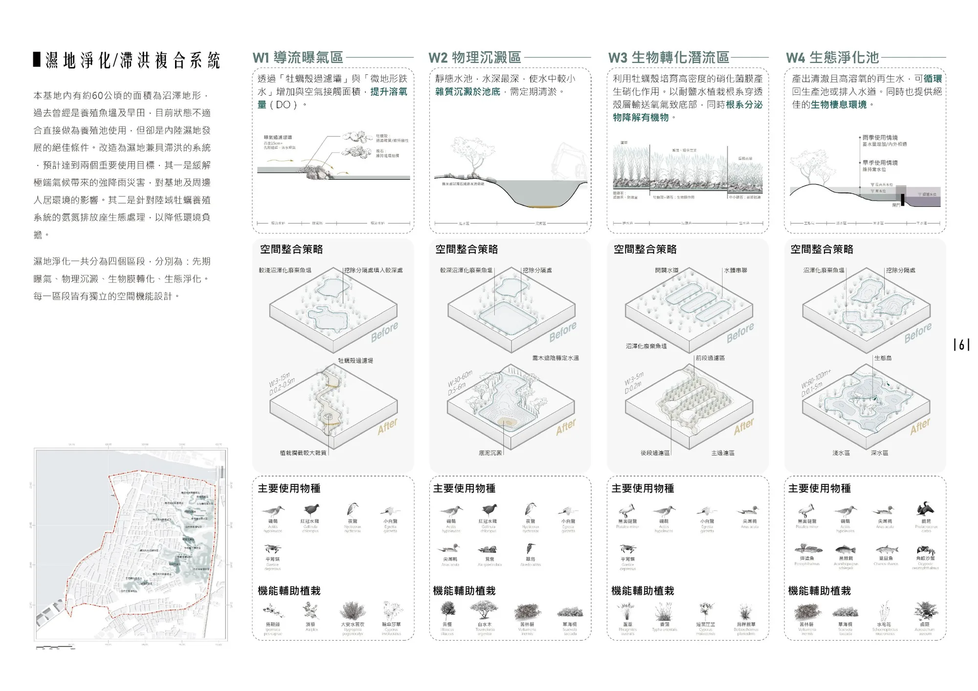
Wetland purification and detention
W1Aeration channels over oyster-shell weirs raise dissolved oxygenW2Deep settling basins drop out suspended solidsW3Subsurface-flow beds where shell biofilm and salt-tolerant roots break down nitrogenW4Polishing ponds return clean water and give birds a habitat
One seawater loop runs the whole site.
Six sluice gates use the rise and fall of the tide to draw seawater in and let it out. A main channel about 10 km long carries it into a network of secondary channels that reach every pond, like veins. The farm draws what it needs, its nutrient-rich effluent passes through the wetland to be cleaned, and the clean water rejoins the main channel. In heavy rain the same channels store floodwater and release it on the ebb tide.
- H1 Main channel brings seawater inSix gates and about 10 km of channel. Average supply of 2,000,000 m³ a day.
- H2 Secondary channels spread it outBranches reach every farm pond, and in a storm let runoff drain back to the main channel.
- H3 The farm uses seawaterEven at high tide the channels can supply everything the oyster system needs.
- H4 The wetland filters itAmmonia-rich effluent from finishing and nursery ponds, up to 12,221 m³ a day, is cleaned in a wetland that can treat 90,000 m³. Water is reused at 100%.
- H5 The wetland holds the floodTreated water returns to the main channel. In the rainy season the wetland stores runoff from the site and from the villages east of Provincial Highway 61.
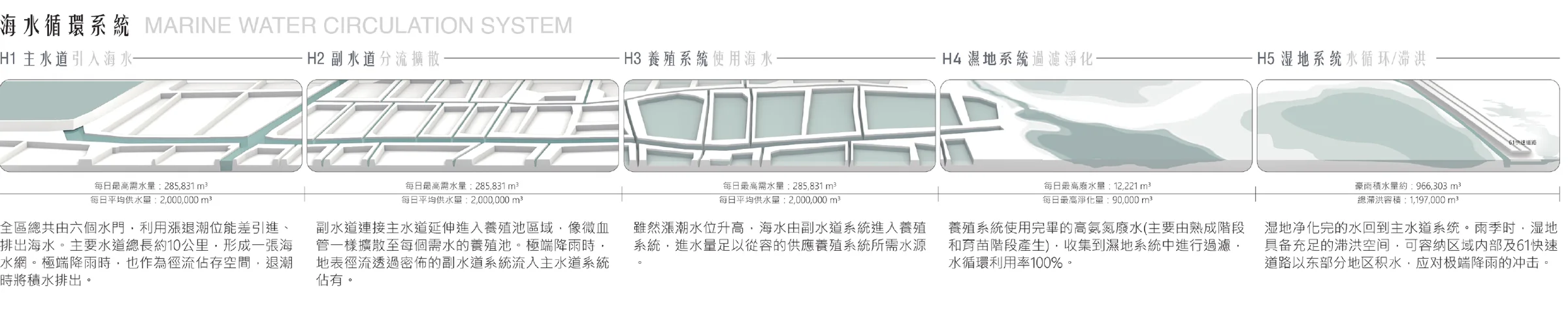
Seawater circulation system H1–H5.
A landscape that switches with the season.
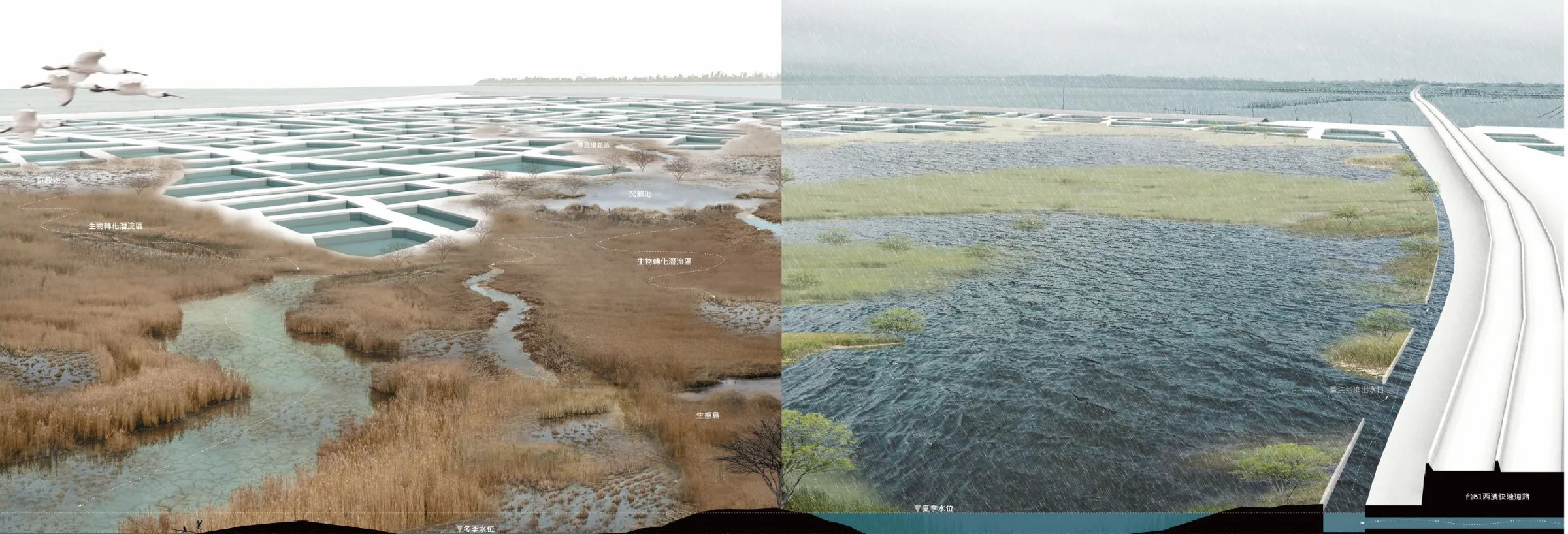
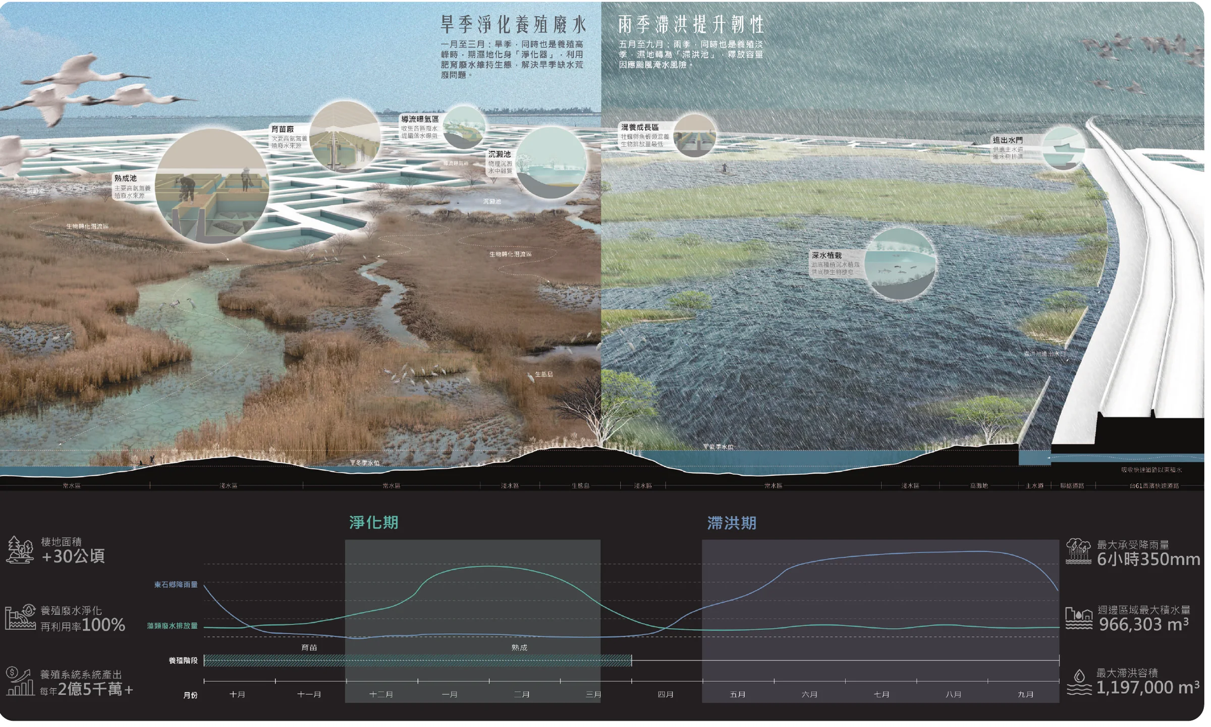
Dongshi has a distinct dry and wet season, and the wetland changes role with it. From December to March, when farm effluent peaks during oyster finishing, it works as a staged filter. From May to September, when typhoons and southwesterly storms arrive, it drains down and becomes a sponge that absorbs runoff from the villages and the coastal expressway.
A pavilion shaped like the shell it serves.
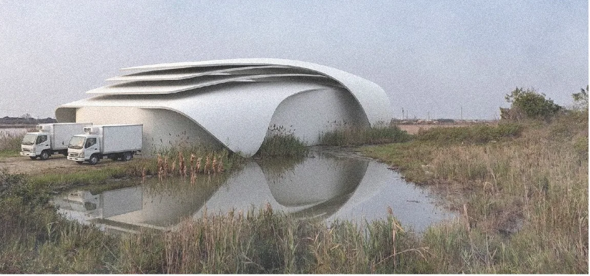
The depuration hall takes its layered roof from the growth rings of an oyster shell. The folds carry solar panels and channel the summer southwesterly wind through bladeless turbines, so the sterile nursery runs on its own power.
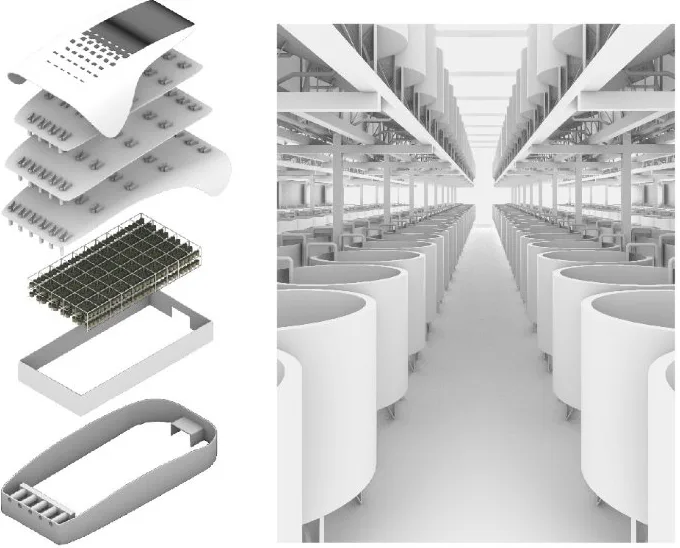
- Solar roofAbout 700 m², 140 kWp
- Bladeless wind layer15 units, about 1,000 kW
- Nursery and depuration tanksTwo tiers, up to 600 one-tonne tanks
- Positive-pressure clean roomFiltered intake air keeps the nursery sterile
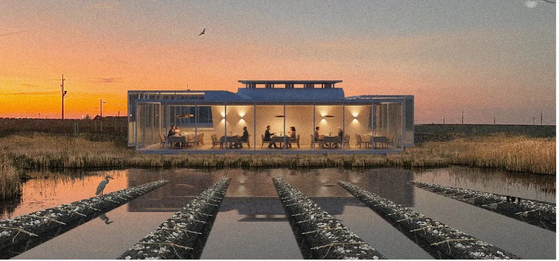
Beside it, an outreach center translates the local courtyard house. Visitors walk through an aquaculture exhibition before reaching a dining room that looks out over the finishing ponds and the restored wetland.