IFLA Global Studio Program 2025
2025 全球學生設計工作坊計畫系列作品
Four cities, four rapid design charrettes with international teams. First place overall across the 2025 series.
- Program
- IFLA Global Studio Program 2025
- Year
- 2025
- Type
- International student charrettes
- Role
- Team member. My part in each charrette is listed below.
- Cities
- Nantes, Santiago, Mumbai, Wuhan
- Award
- First Place Award, overall ranking
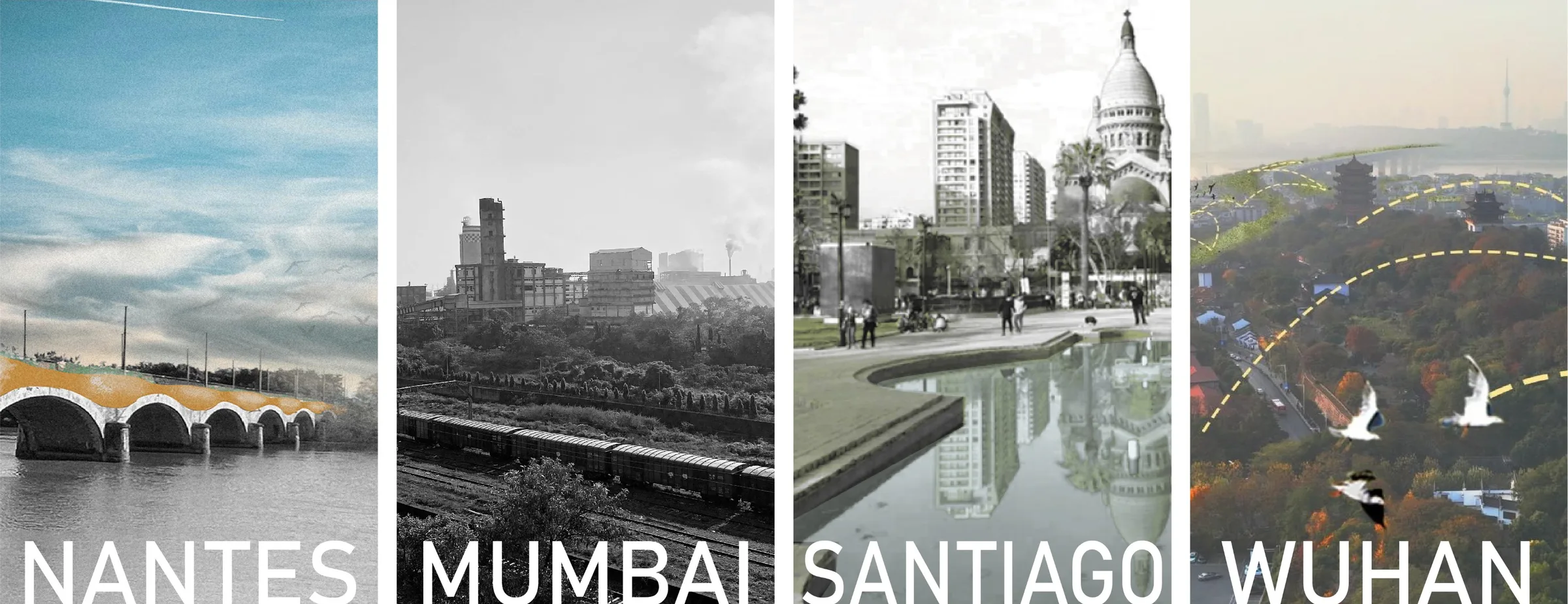
Four cities, four teams, a few days each.
The Global Studio Program is run by IFLA, the International Federation of Landscape Architects. Students from design schools around the world are selected and mixed into multinational teams, then given a few days to research a site and present a proposal to an international jury.
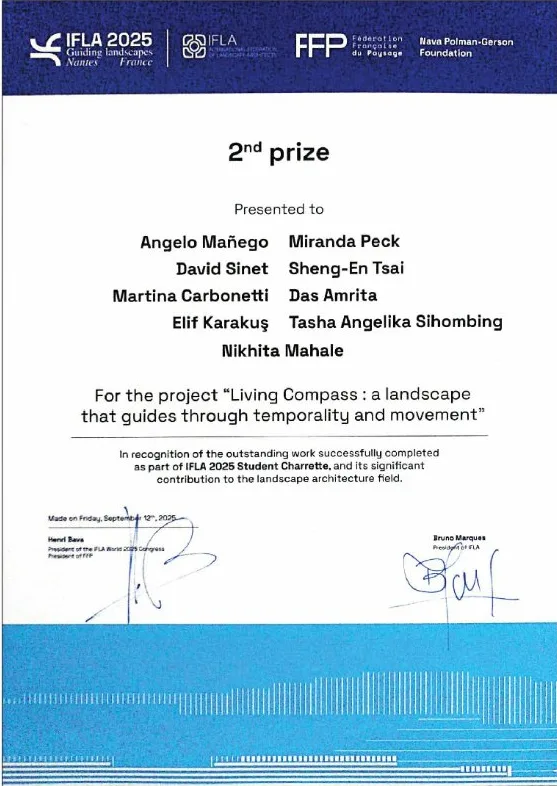
The 2025 series ran in four cities, each with a different urban question: river ecology and time in Nantes, drought and extreme rain in Santiago, infrastructure growth against ecological memory in Mumbai, and restoring the mountain-and-water order of an old city under dense development in Wuhan. Across the four charrettes, my teams took second prize in Nantes and Mumbai and an honorary award in Wuhan, which together placed first in the year’s overall ranking.
These are fast projects, made in days with teammates I had just met. They show how I work under time pressure and across languages and cultures more than they show finished drawings.
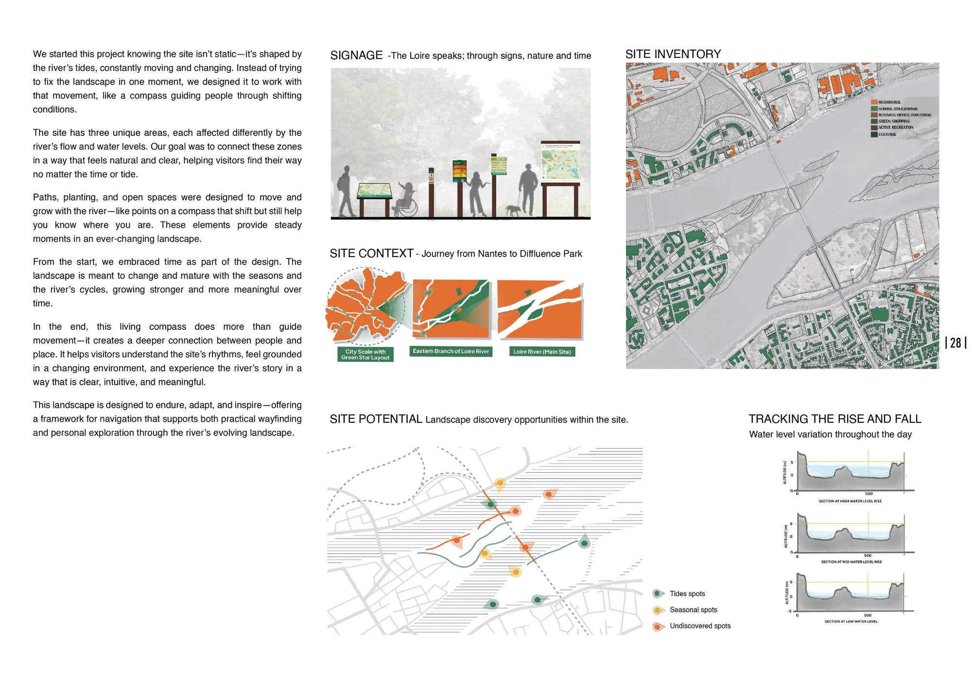
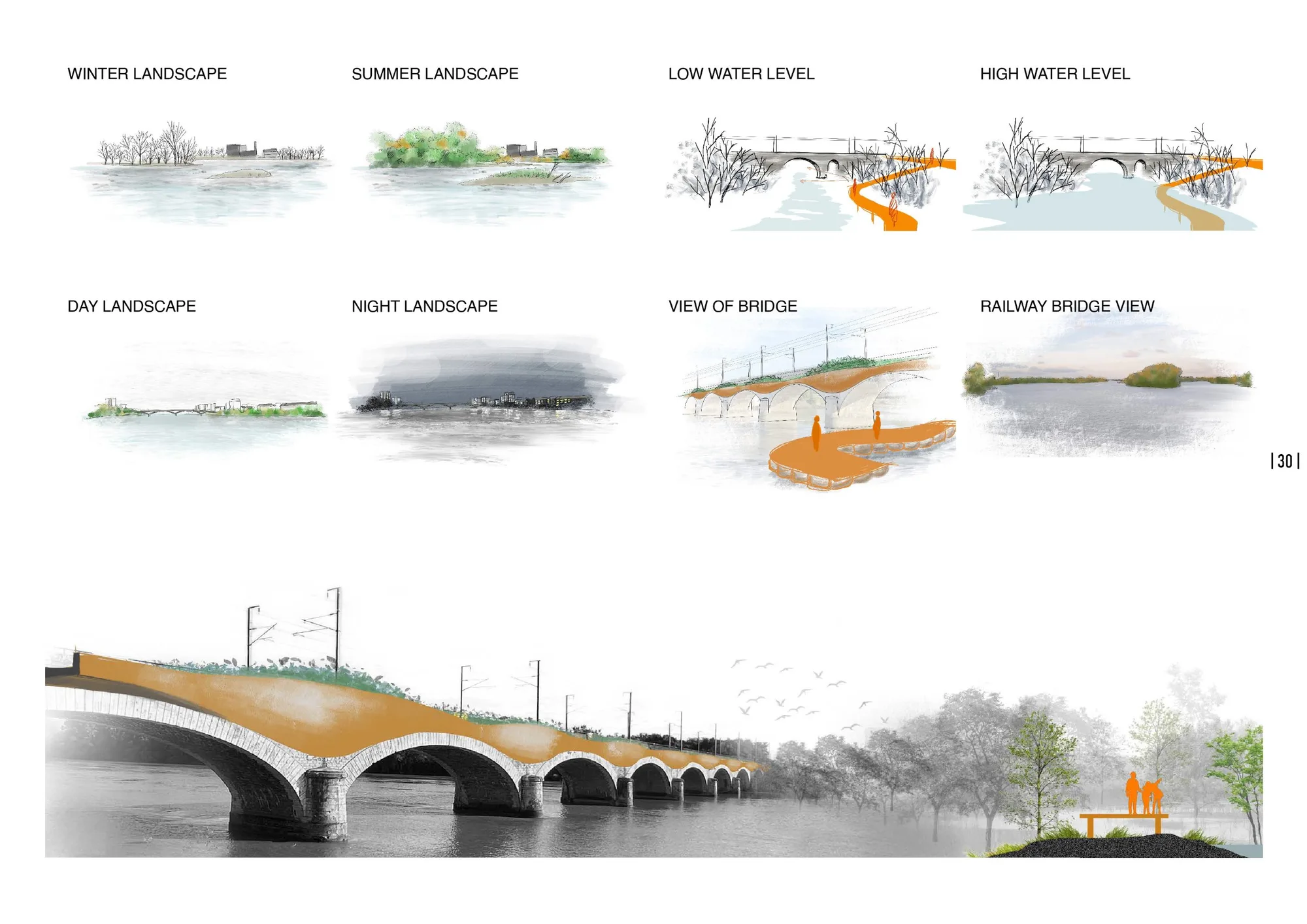
Living Compass: a landscape that guides through temporality and movement.
The site sits on the upper Loire beside the Île de Nantes, at the edge of the city’s Green Star plan, where urban expansion meets wild river islands. The river rises and falls with the tide, the seasons and floods, so the landscape is never in one state for long.
Rather than fix the site in a single moment, the team treated erosion, sedimentation, water level and wildlife movement as a wayfinding system. Paths move from the dense city edge through parks and farmland to untouched marsh islands. Floating platforms that rise with flood water, a watchtower and semi-submerged walkways turn changing water levels into a way of reading the site, and differentiated maintenance lets each zone mature over time.
- My role
- Master plan, design framework, site plan, perspective renderings, hand-drawn perspectives, layout
- Advisor
- Daniel Jauslin
- Team
- Miranda Peck (USA), David Sinet (France), Tasha Angelika Sihombing (Indonesia), Angelo Mañego (Philippines), Elif Sena Karakuş (Turkey), Amrita Das (India), Nikhita Mahale (India), Martina Carbonetti, Sheng-En Tsai (Taiwan)
- Award
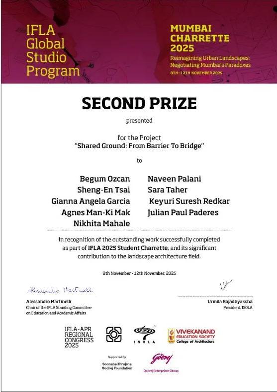
- Second Prize

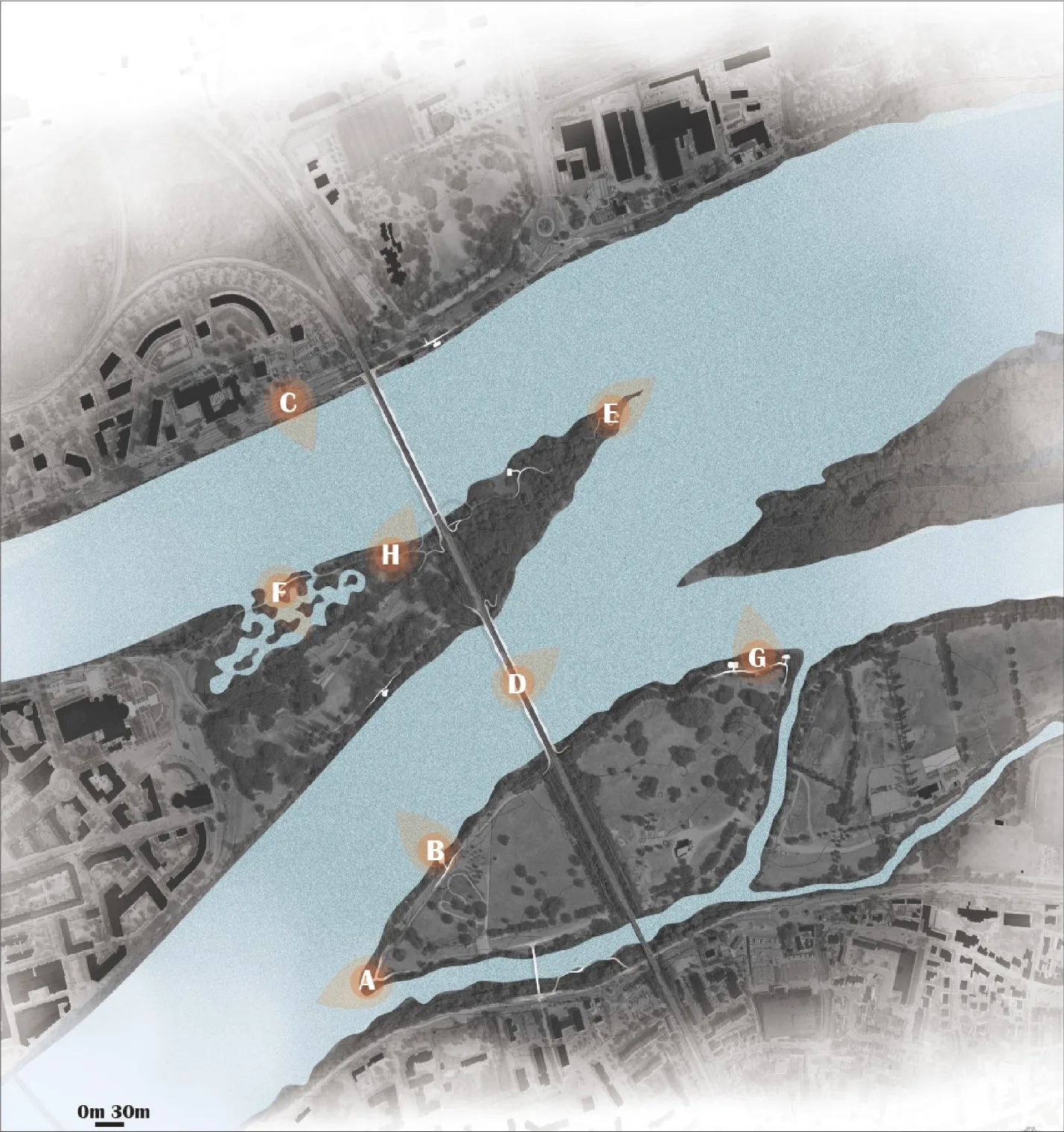
- A · Pedestrian bridgeLookout at the island tip
- B · TowerA view above the canopy
- C · Elevated walkwayCrossing the flood zone on the city bank
- D · Viewing platformOn the railway bridge
- E–H · Bank, deck, river edge, sensory pathDifferent ways down to the water as it rises and falls
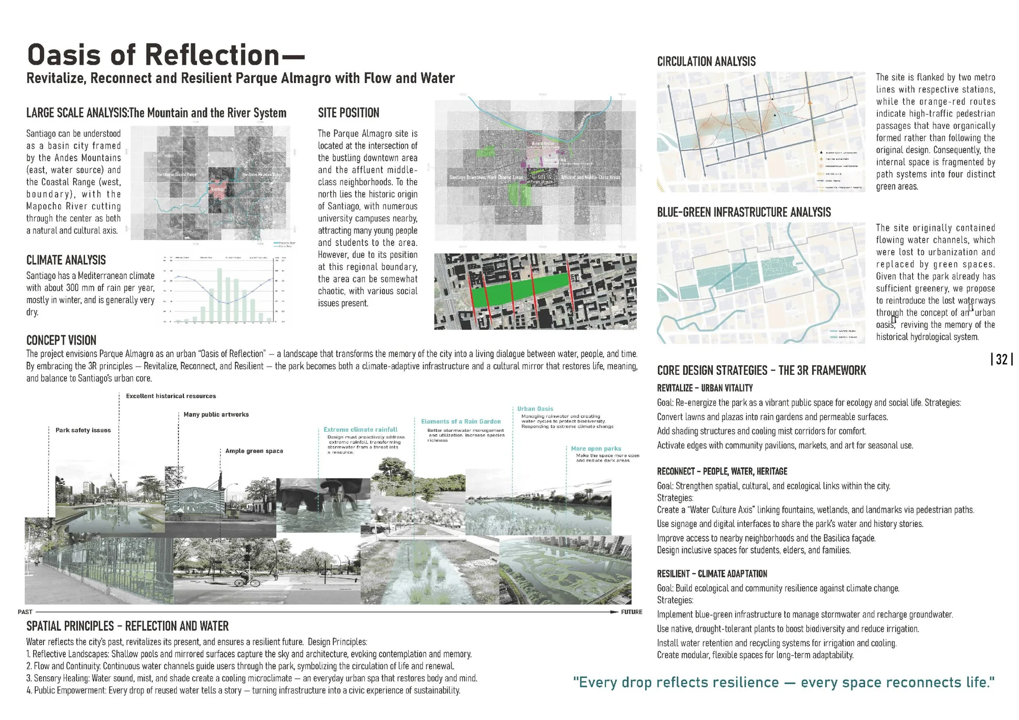
Oasis of Reflection: revitalize, reconnect and resilient Parque Almagro with flow and water.
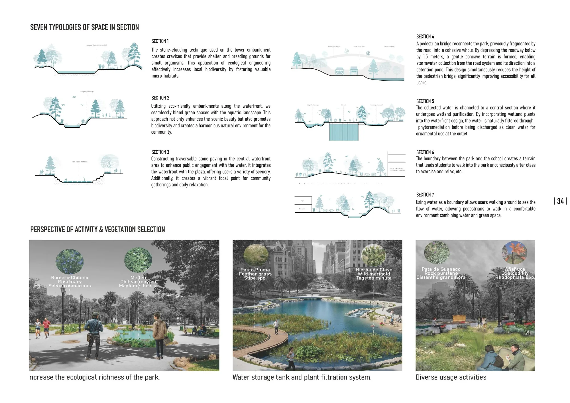
Parque Almagro sits in the middle of Santiago’s basin, between the busy downtown and middle-class neighbourhoods. The city gets about 300 mm of rain a year, almost all in winter, and is otherwise very dry. Water channels once ran through the site but were lost to urbanization, and roads now cut the park into four separate green areas.
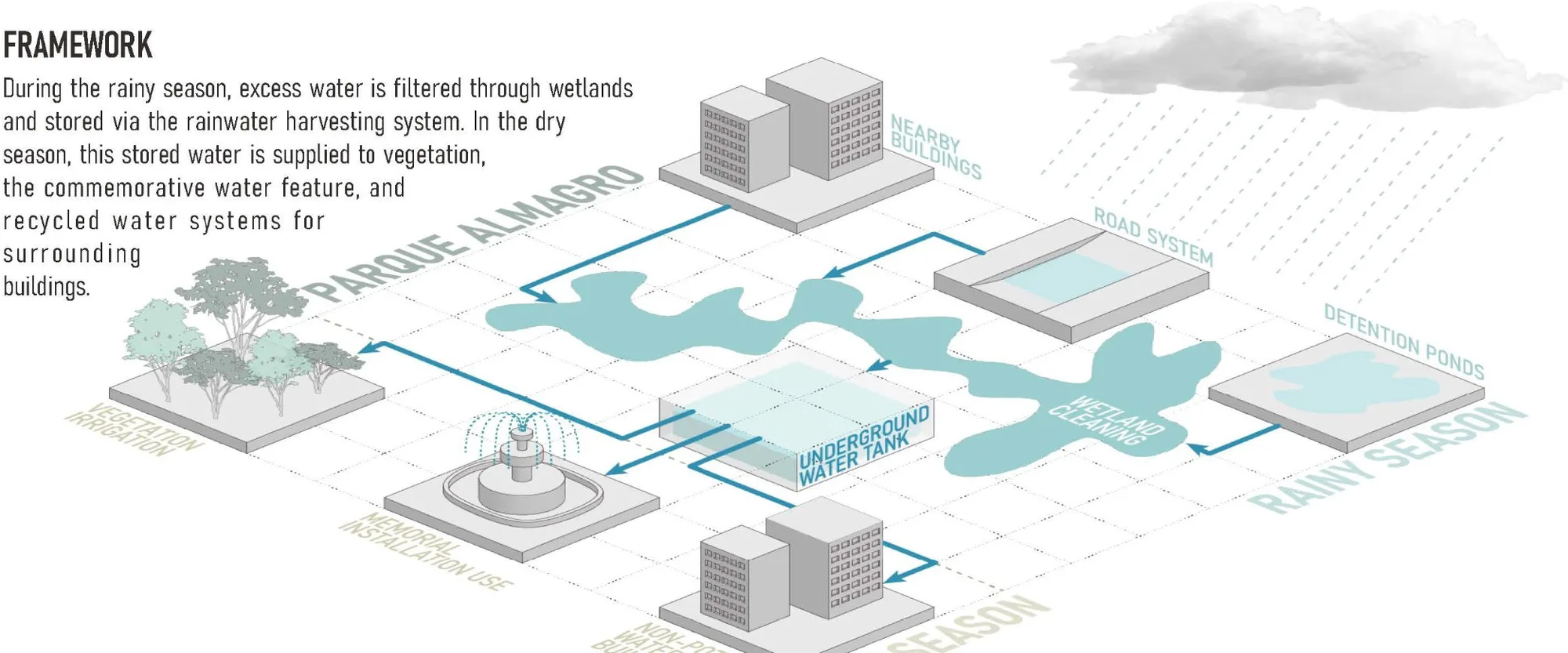
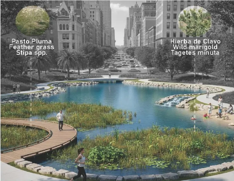
The team proposed a 3R framework: revitalize, reconnect, resilient. A blue-green system stores winter rain in detention ponds and filtering wetlands, then uses it in the dry season for mist cooling and irrigation. Lowering the cross street by 1.5 m lets a gentle pedestrian bridge rejoin the park and sends road runoff into the ponds. A water culture axis links fountains, wetlands and the Basilica, whose reflection falls into the pools.
- My role
- Site analysis, master plan, layout
- Advisors
- Prof. Wen-Shan Huang, Yu-Wen Lin, Prof. Mónica Pallares
- Team
- Rebeca Caballero (Mexico), Fernando Francisco Mayorga Corral (Mexico), Mohana M. Alabdullah (Saudi Arabia), Ali H. Albasha (Saudi Arabia), Ming-Cheng Ho (Taiwan), Basil Alzahrani (Saudi Arabia), Ammar Alnaja (Saudi Arabia), Sheng-En Tsai (Taiwan)
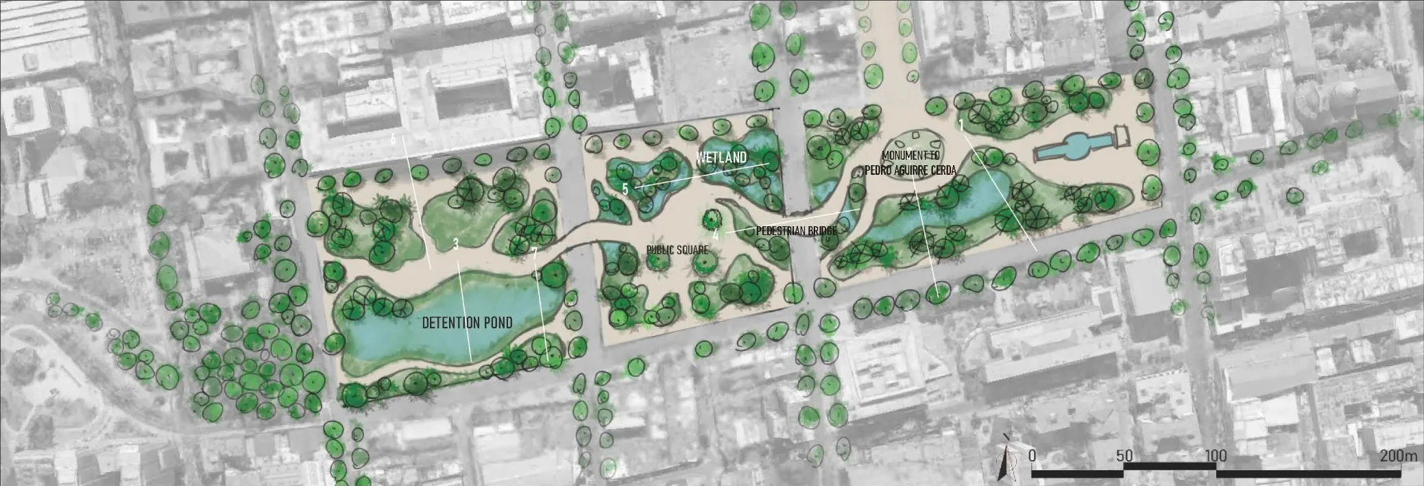
Master plan. Scale bar 0–200 m.
Shared Ground: from barrier to bridge.
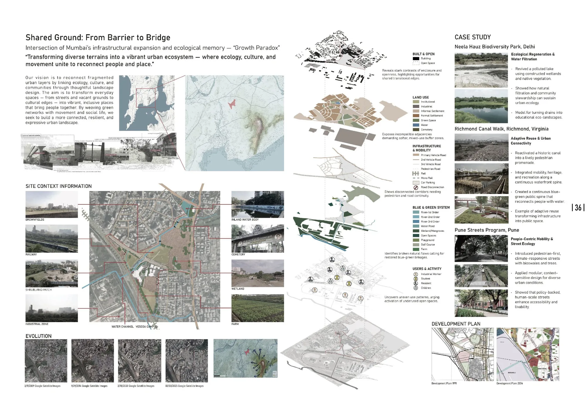
Mumbai’s rapid growth has left forgotten edges between canals, railways, industry and informal settlements. The site is one of these contradicting edges, with brownfields, a polluted canal, a cemetery, a college campus and farmland side by side.
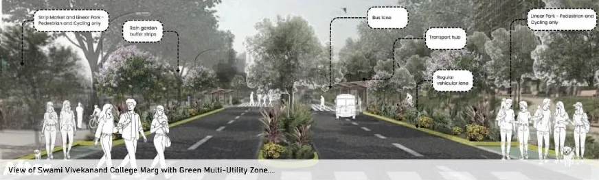
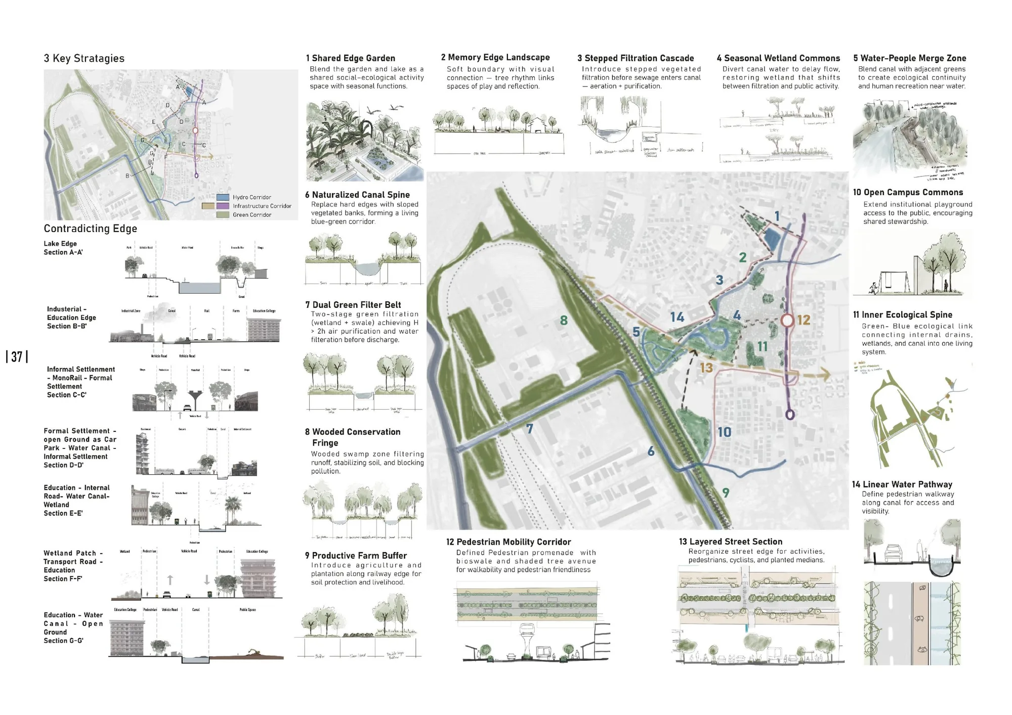
The team mapped seven edge conditions and set out a source-to-outlet strategy along three corridors for water, infrastructure and green space. Stepped filtration cascades and seasonal wetland commons aerate and clean sewage before it reaches the canal, and double as public ground that changes with the monsoon. Productive farm buffers and wooded belts along the railway and industrial edge stabilize the soil, filter air pollution and give residents a livelihood. Planting uses phytoremediating species such as cattail, vetiver and Indian lotus to treat heavy-metal pollution.
- My role
- Site analysis, concept development, drawings and layout
- Advisor
- Neha Shah
- Team
- Begum Ozcan (Turkey), Gianna Angela Garcia (Philippines), Agnes Man-Ki Mak (Hong Kong), Naveen Palani (India), Sara Taher (Lebanon), Keyuri Suresh Redkar (India), Julian Paul Paderes (Philippines), Nikhita Mahale (India), Sheng-En Tsai (Taiwan)
- Award
- Second Prize
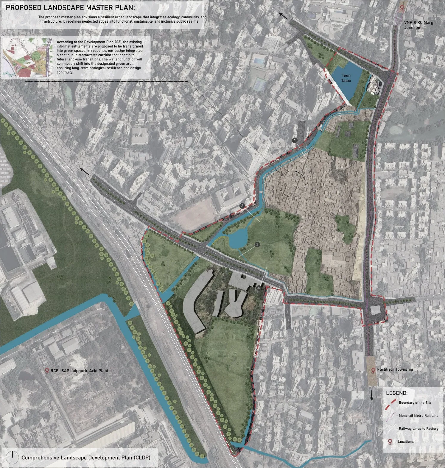
- Hydro corridorNaturalized canal banks, filtration cascades and seasonal wetland commons
- Infrastructure corridorPedestrian promenade with bioswales and a layered street section
- Green corridorFarm buffer and wooded conservation fringe along the railway
- Plan 2031 readyWetlands designed to extend as the settlement turns to green space under the city plan
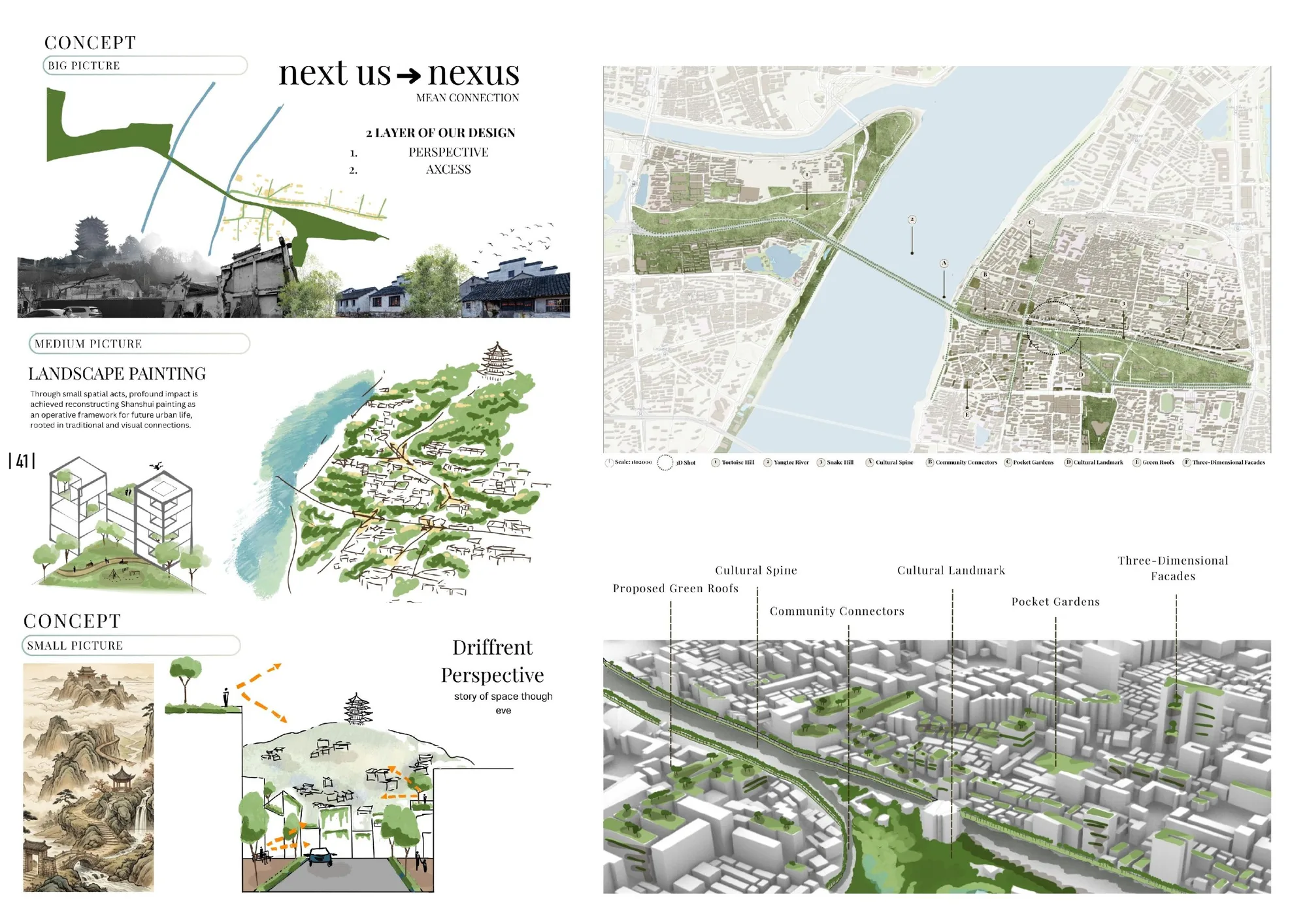
Next Us → Nexus. Living Shanshui: weaving a resilient nexus of history, ecology and urban life.
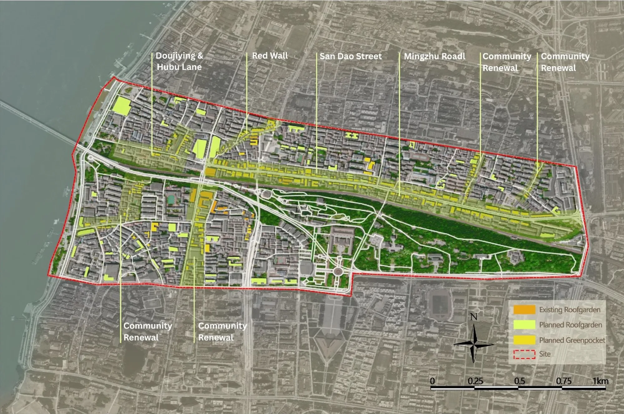
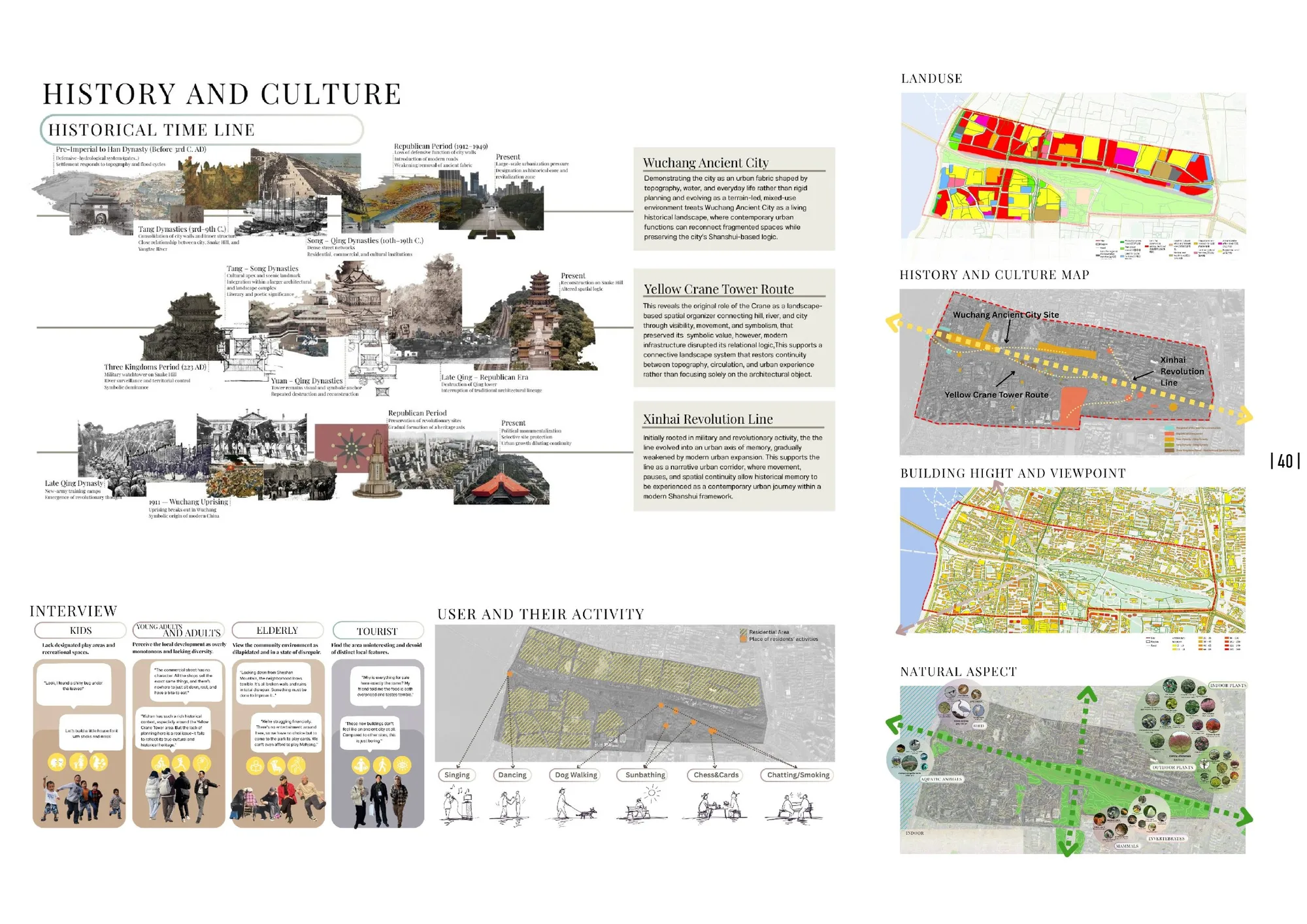
The site is the old city of Wuchang, under heavy development pressure. Local legend says Snake Hill and Tortoise Hill guard the Yangtze, and the city grew around that relationship of mountain and water. Modern roads and dense blocks have cut it apart. Tracing the Yellow Crane Tower route and the 1911 Xinhai Revolution line showed a city shaped by terrain, water and daily life rather than a fixed plan.
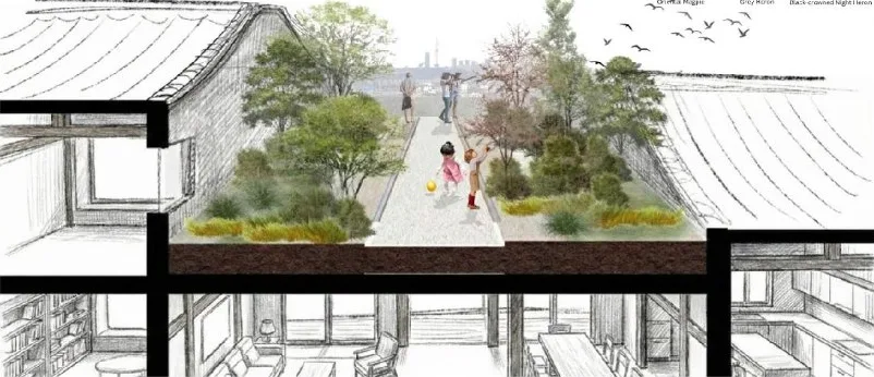
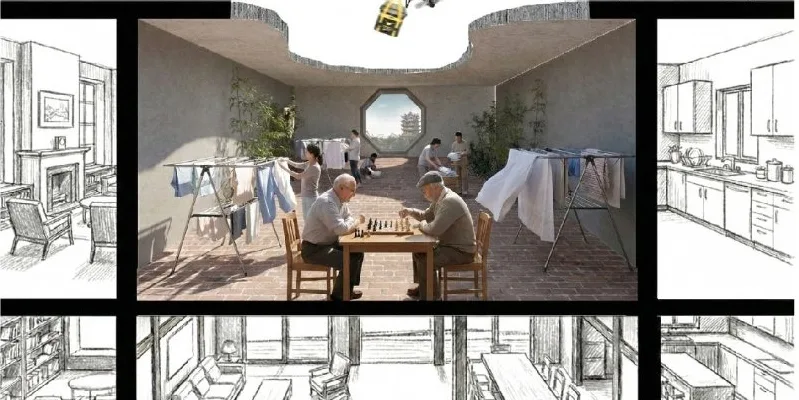
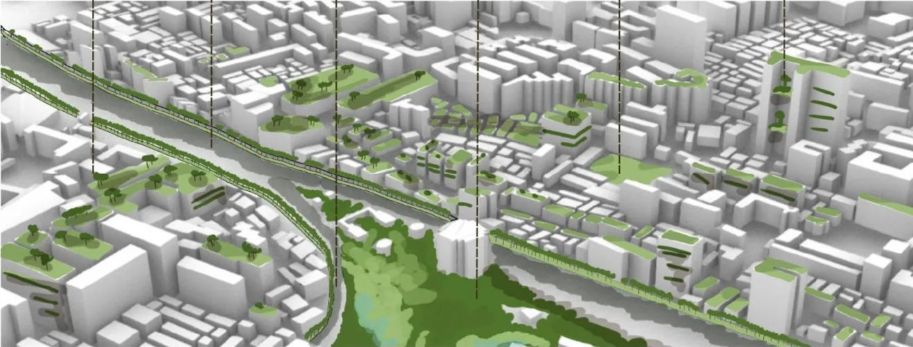
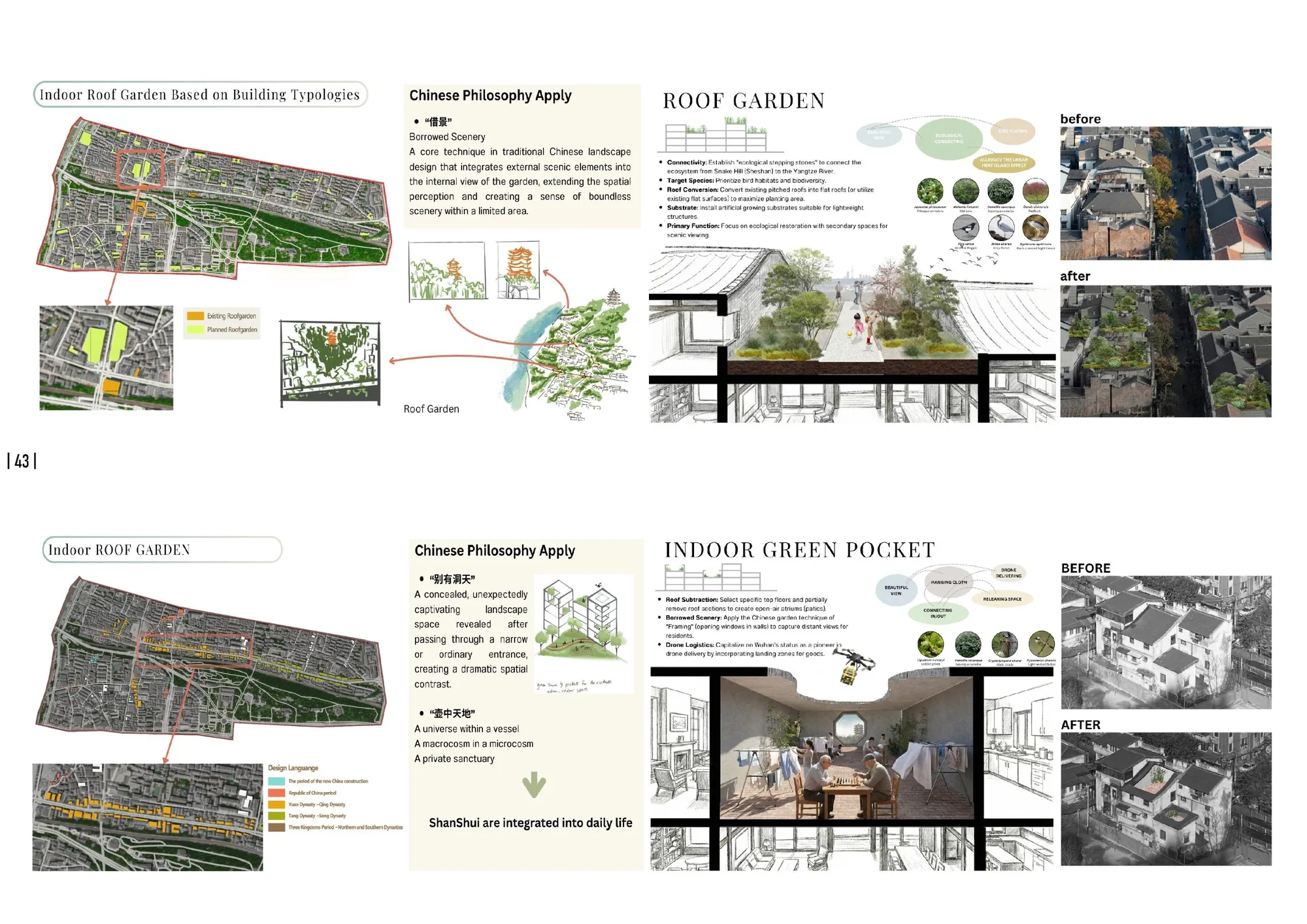
The proposal turns the composition of shanshui painting into an urban framework at three scales. At the city scale, Snake Hill becomes an ecological spine that ties restoration, heritage and community life together. At the neighbourhood scale, the classical garden ideas of borrowed scenery (借景) and a hidden world behind a narrow entrance (別有洞天) bring landscape into the dense residential streets. At the building scale, roof gardens and indoor green pockets give birds such as the grey heron stepping stones toward the river, and make room for Wuhan’s drone deliveries on shared rooftops.
- My role
- Analysis, concept, master plan, detailed design, renderings
- Advisor
- Yang Diechuan (杨叠川)
- Team
- Boonyawe Sookchitt (Thailand), Hou Jiayi (侯嘉怡, China), Aseel Shahrour (Lebanon), Sara Taher (Lebanon), Sheng-En Tsai (Taiwan)
- Award
- Honorary Award