The Coexistence Ark
創造人與自然環境共生的方程式
Bringing a polluted urban creek back as the spine of a park that grows food, holds water and shelters wildlife.
- Site
- Guizikeng Creek, Taishan District, New Taipei
- Year
- 2025
- Type
- Landscape design studio
- Role
- Individual work
- Advisor
- Prof. Nai-Wei Hsiung
- Scale
- 5.2 km creek, 5 ha core park
A creek that lost its landscape twice.
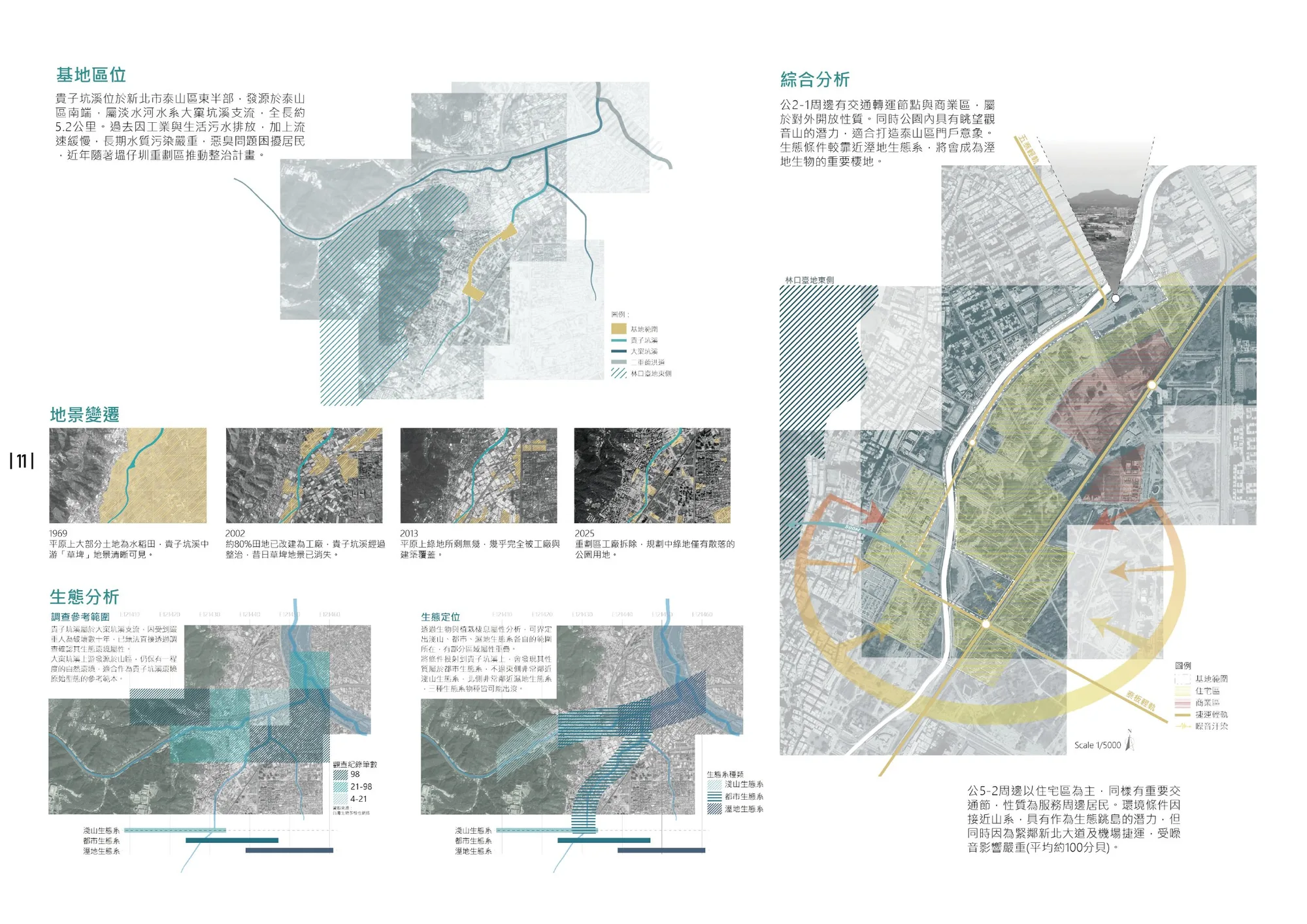
Guizikeng Creek runs 5.2 km down from the hills of southern Taishan to join Dakeng Creek in the Tamsui River system. In 1969 the plain around it was rice paddy. By 2002 about 80% of that farmland had become factories, and decades of industrial and household discharge left the creek slow, polluted and foul-smelling.
Factories are now being cleared for the Wuguzi redevelopment district. The plan leaves only scattered park lots for green space, beside a new arterial road and an airport MRT line where noise reaches around 100 dB.

Three reaches, three kinds of nature.
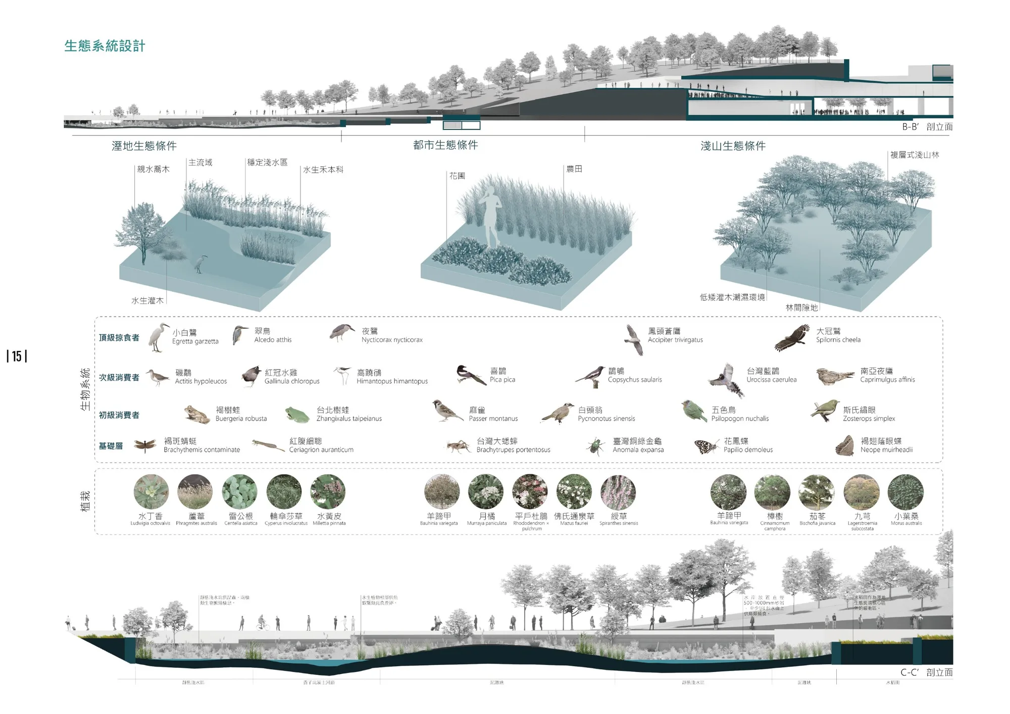
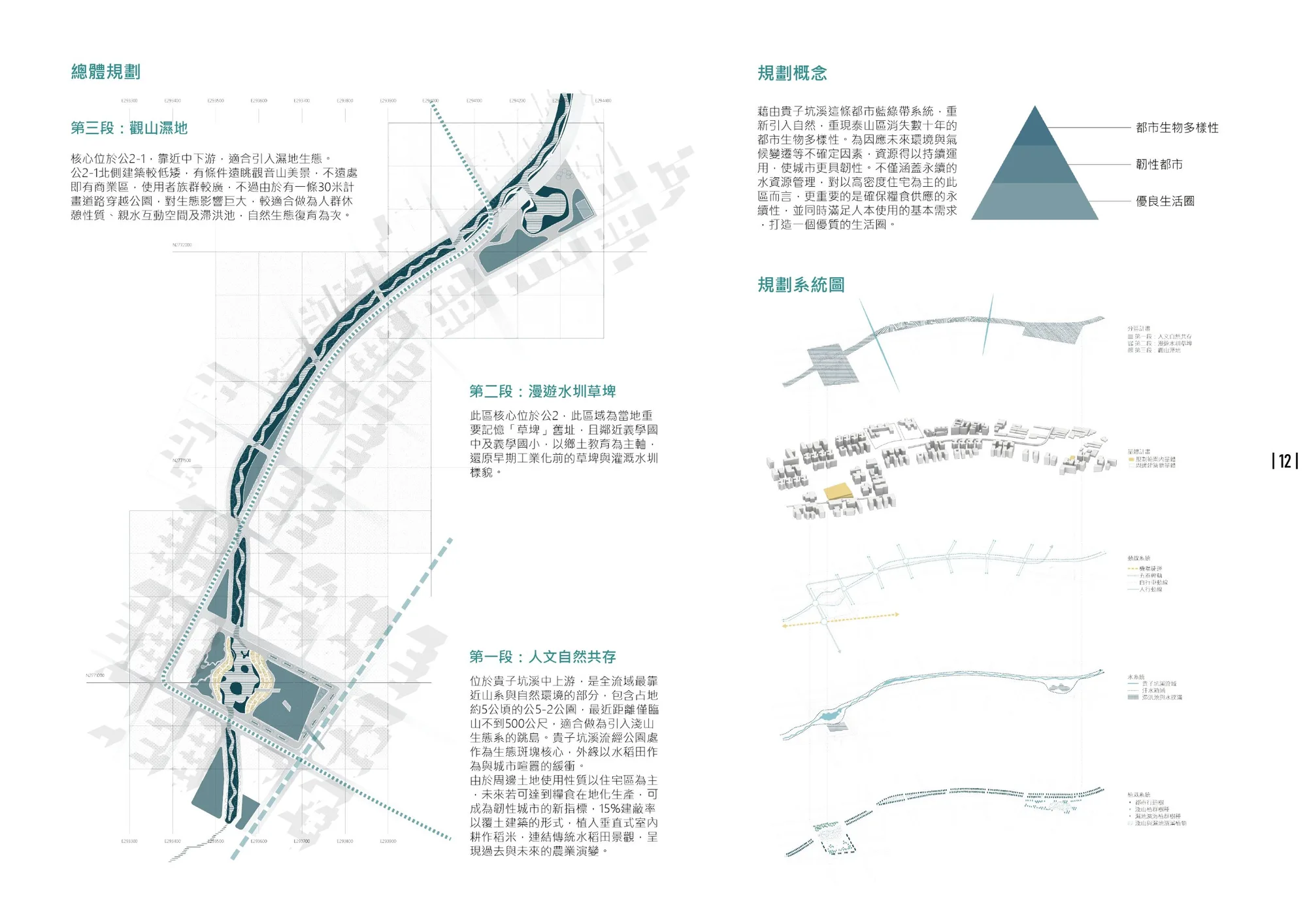
Ecological surveys of the upstream catchment showed three systems meeting along the creek: low-hill forest, urban habitat and wetland. Each reach of the corridor is designed around the one closest to it.
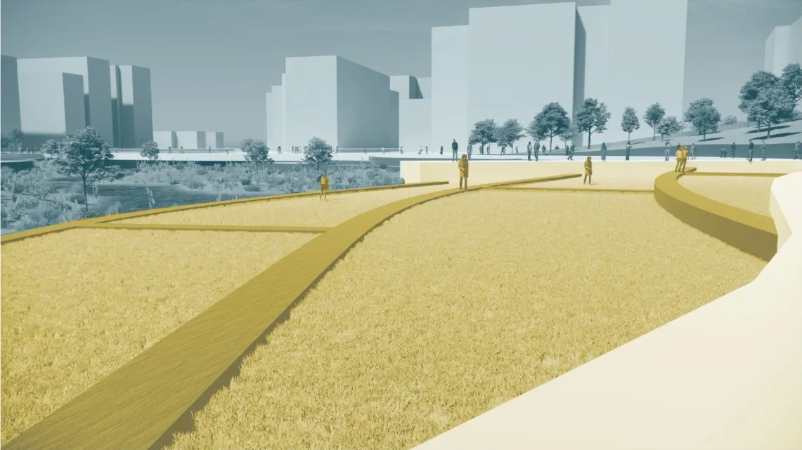
A 5 ha park under 500 m from the hills becomes a stepping stone for hill ecology, with rice paddies as a buffer against the city.
Restores the irrigation canals and pond meadow that stood here before industry, beside two schools, as an outdoor classroom.
Near the MRT and commercial zone, a waterfront park with views to Guanyin Mountain doubles as flood detention.
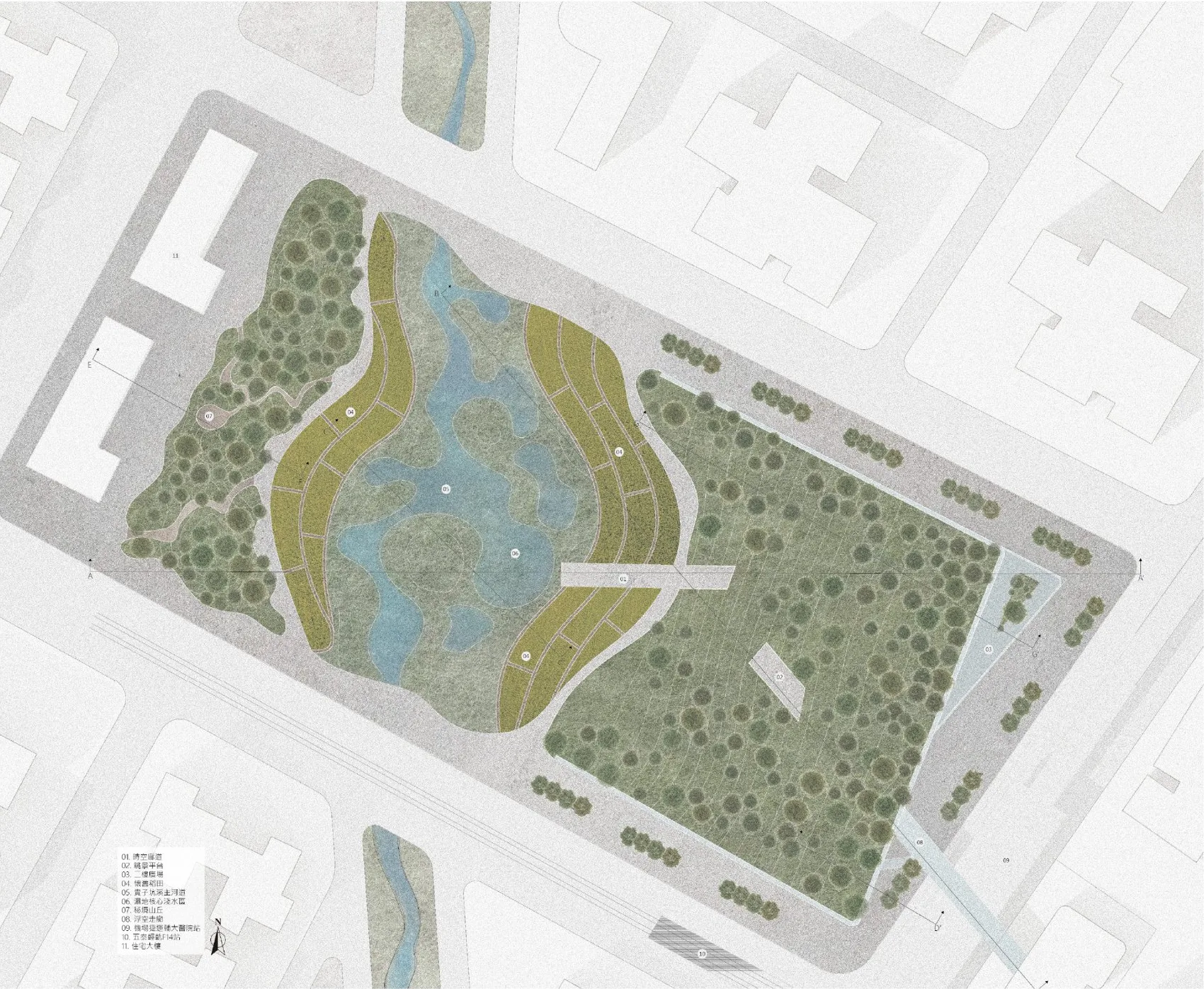
Wetland in the middle, paddies around it, forest at the edge.
The core park in Reach 1 is laid out as an ecological patch. A wetland core of shallow pools and mudflats sits at the centre, sized from at least 0.5 ha for amphibians and small birds toward the 3–5 ha small mammals need. Terraced rice paddies wrap it as a buffer, and a layered low-hill woodland lines the outer edge.

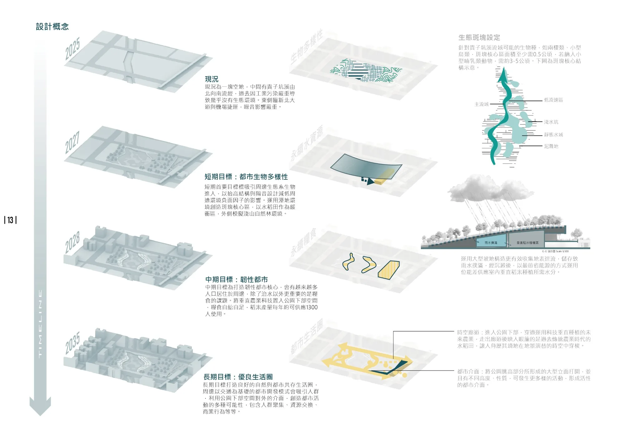
A ten-year path from empty lot to neighbourhood.
- 2025 ExistingVacant land, a polluted creek, heavy traffic noise.
- 2027 Urban biodiversityRaised structures and noise screening let wildlife return to the wetland core.
- 2028 Resilient cityVertical rice farming under the park grows enough rice for about 1,338 people a year.
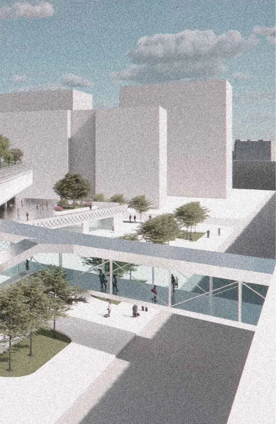
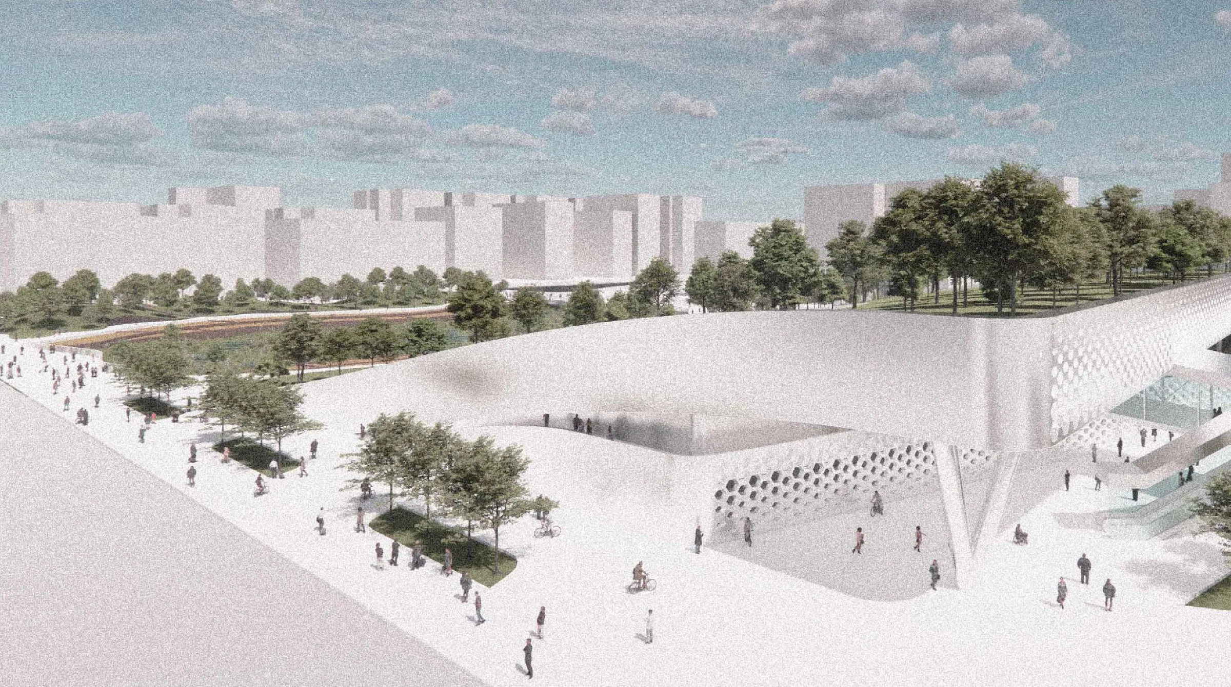
- 2035 A good place to liveThe opened-up underside of the park becomes a street front for markets, gatherings and exchange.
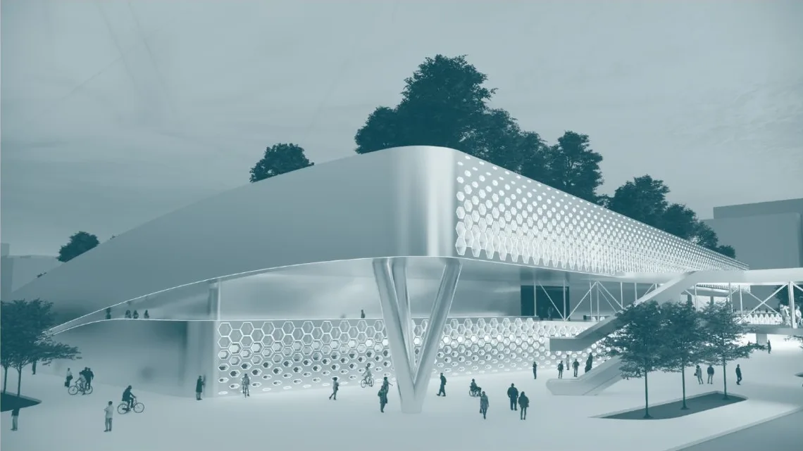
The large slope collects surface runoff into a cistern. After settling, the water flows by gravity to the indoor rice farm below, so irrigation uses almost no pumping energy. The building covers 15% of the park, under an earth-covered roof.
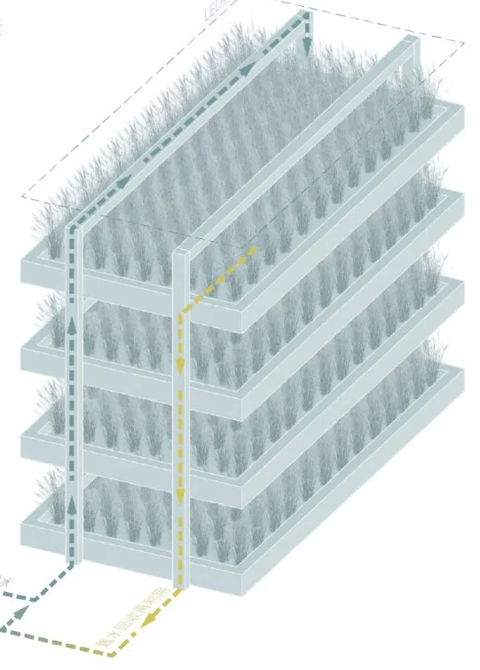
A building that farms rice and absorbs the train.
Under the planted slope, four tiers of indoor paddies grow rice under LED light. Controlled light, temperature and nutrients cut the growing cycle from about five months to 60–70 days, so each tier yields five harvests a year at roughly 0.9 kg per square metre.
- 98.8 tonnes of rice a year5,491 m² × 4 tiers × 0.9 kg/m² × 5 harvests
- About 1,338 people fedAt 65% milling yield and 48 kg of rice per person per year in Taiwan
- 36× the yield, 92.8% less waterCompared with a conventional paddy of the same footprint
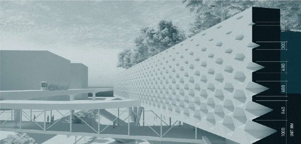
The facade facing the airport MRT is a deep honeycomb of tapered cells. Train noise sits mostly between 50 and 200 Hz, wavelengths of 6.86 to 1.72 m, and a cavity a quarter of a wavelength deep traps it. Cell depths run from 1.72 m down to 0.30 m, absorbing fully across 50–285 Hz and lowering noise by about 20–30 dB.
Designing for the food web, from dragonflies to the crested serpent eagle.
Planting is chosen for each of the three habitat types and for the species it supports at every level: insects and frogs such as the Taipei tree frog at the base, birds like the Taiwan blue magpie and white-eye in the middle, and egrets, kingfishers and the crested serpent eagle at the top.