The Carves
基隆市八斗子長潭尾景觀規劃設計
Three landscapes along the Badouzi coast, each shaped by a force that has already carved it.
- Site
- Badouzi, Zhongzheng District, Keelung
- Year
- 2025
- Type
- Landscape design studio
- Role
- Individual work
- Advisor
- Prof. Wan-Chun Teng
- Zones
- Fishing harbour, tidal platform, former landfill
An island that became a peninsula, then a landfill, then a museum.
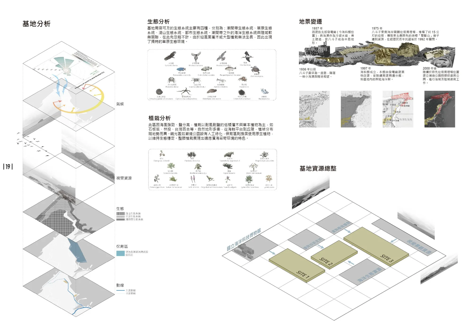
Before 1936, Badouzi was an island separated from Keelung by a narrow channel. In 1937 a power plant filled the channel for its cooling water, and the island became a peninsula. From 1975 a landfill on its east coast piled waste about 15 metres high and almost buried a local landmark hill, until residents forced it to close in 1992. The power plant became the National Museum of Marine Science and Technology in 1997, and restoration parks have been built over the landfill since 2000.
The coast has good scenery, geology and ecology, but it sits between two national scenic areas and gets little of their attention. Its native ecology is intertidal and grassland: the northeast monsoon is too strong for trees on exposed ground.

Use the force that shaped each place.
Every part of the east coast has been carved, by waves cutting the rock platform or by people filling and dumping. The plan links three zones and borrows the largest outside resource each one has.
Changtanli fishing harbour. The marine museum drew over 2.7 million visits in 2023; new routes bring that crowd into a fading fishing village.
An outdoor marine museum. Excavating fill reopens the wave-cut platform to the sea and creates an intertidal zone for teaching and research.
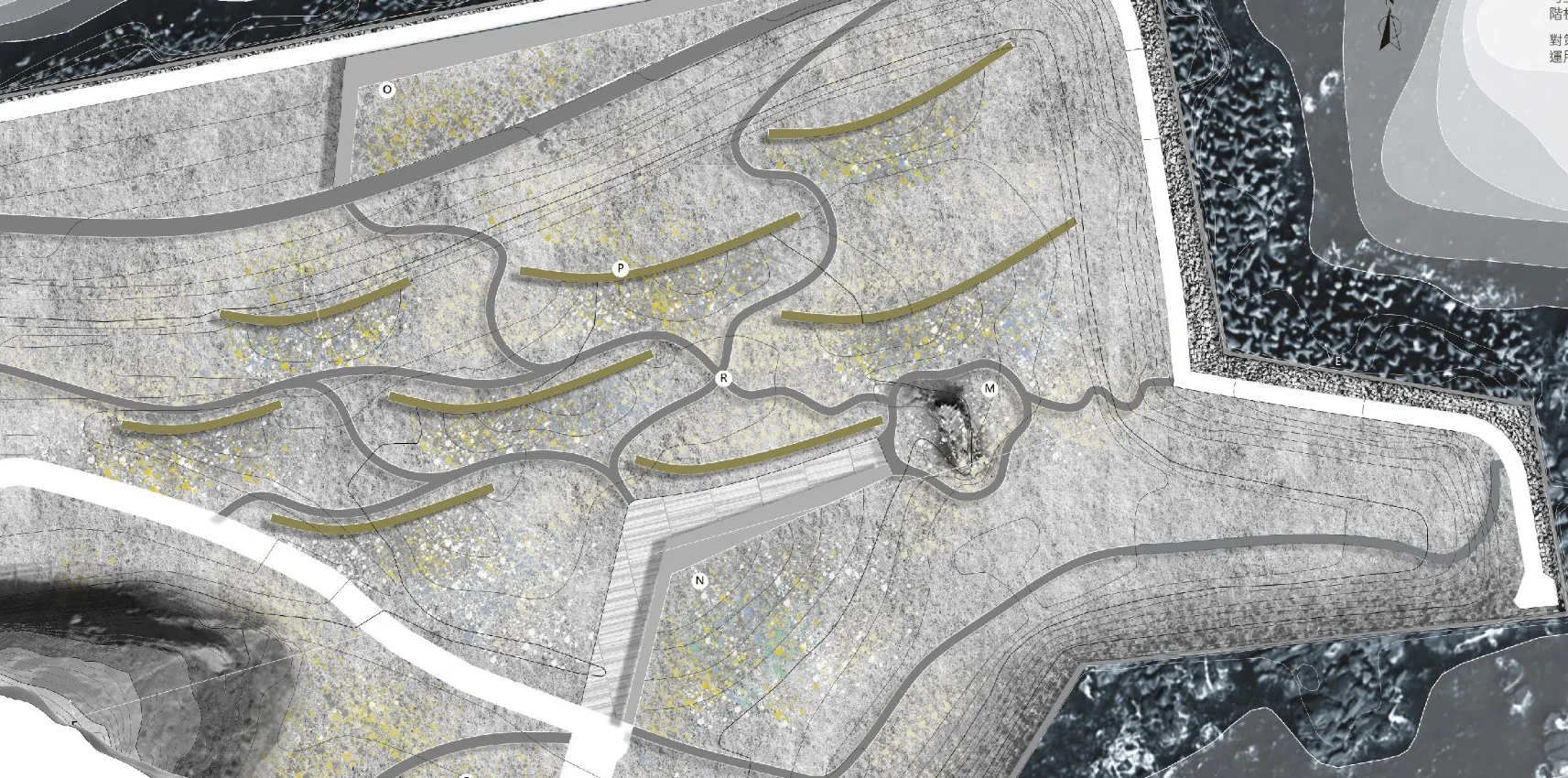
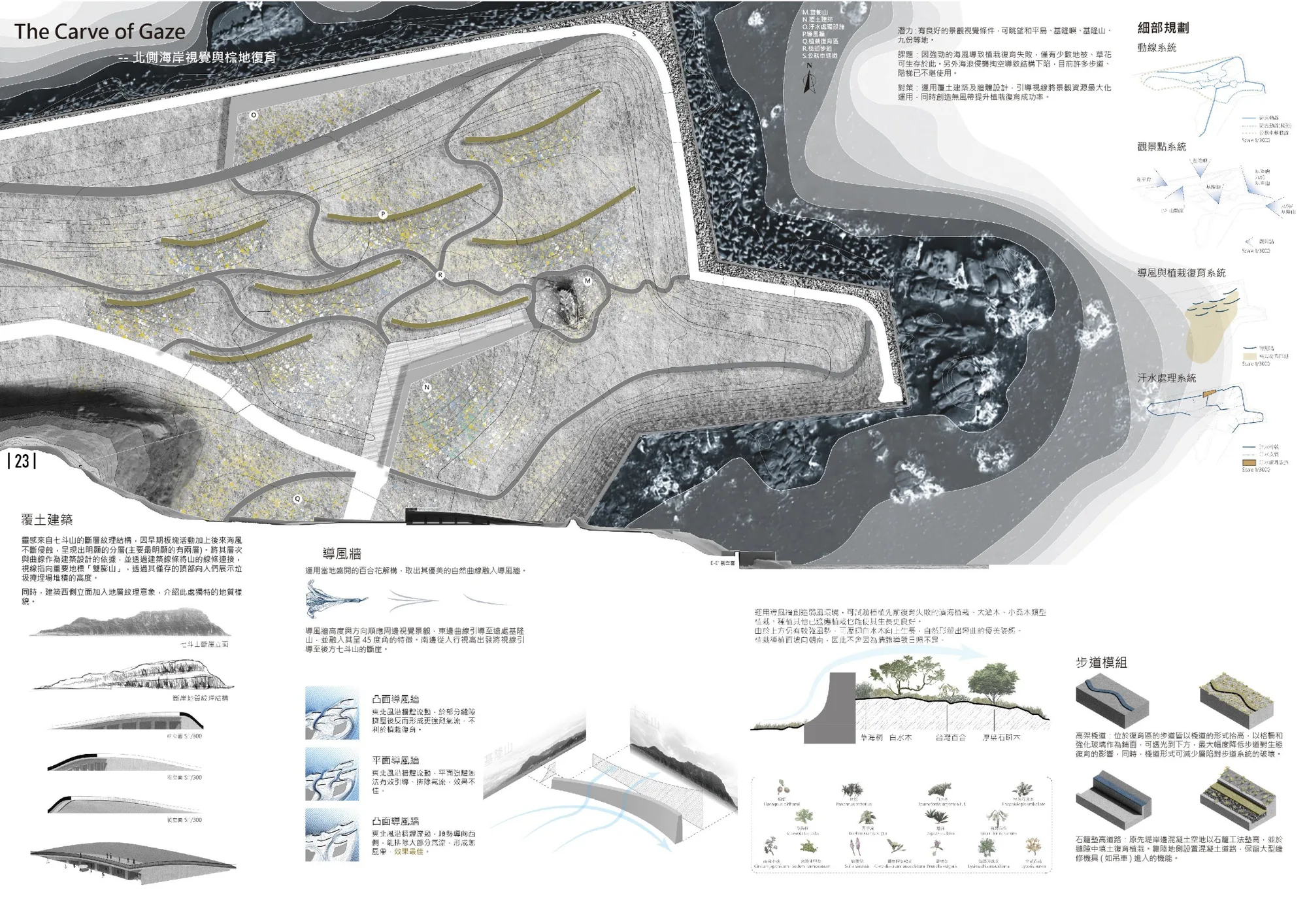
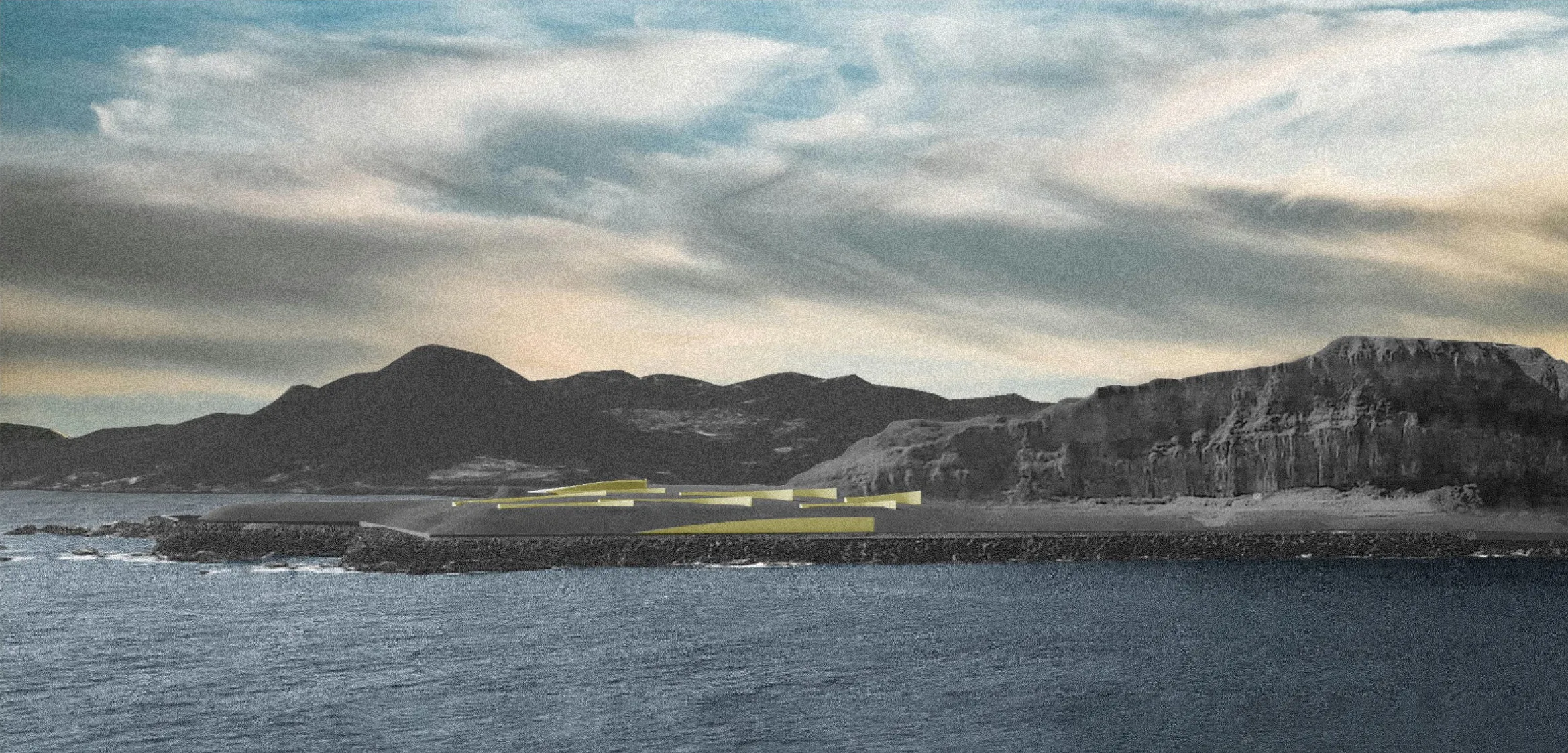
The former landfill. Earth-covered buildings and wind walls frame the views and shelter planting from the monsoon.
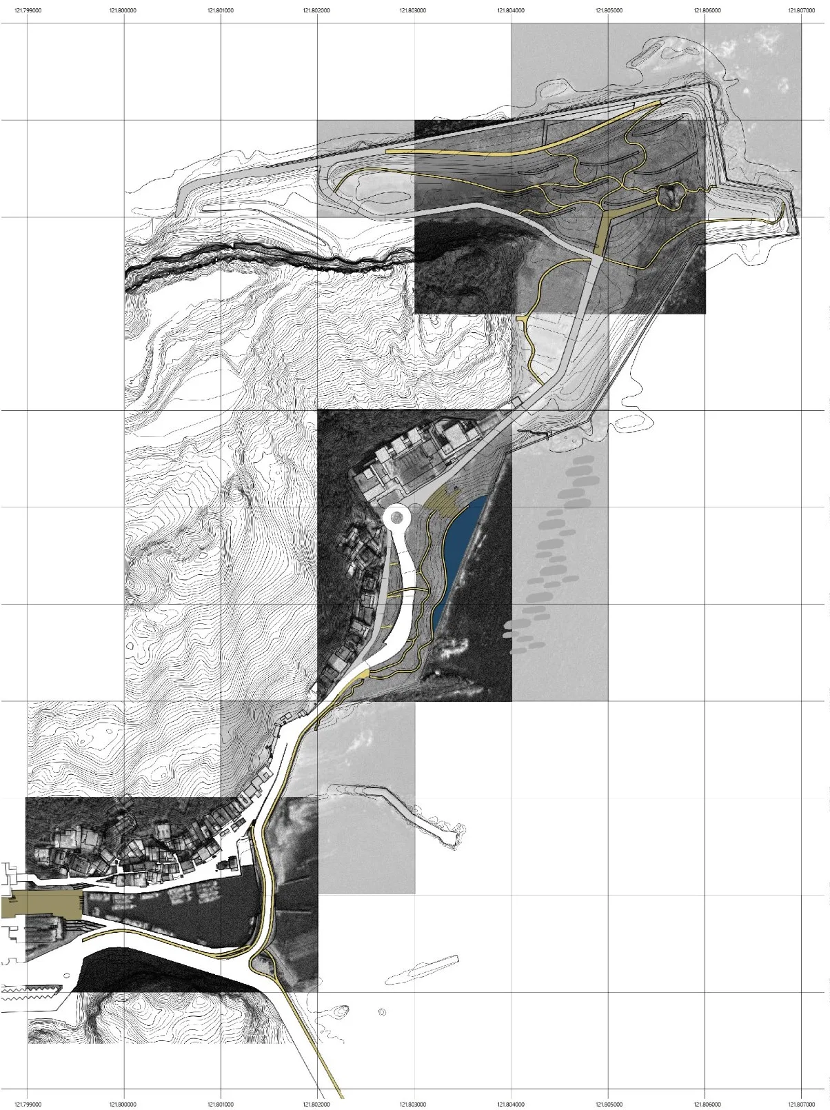
- TraceRerouted paths, a reopened entrance plaza at the old power-plant intake, and a breakwater bridge.
- TideConcrete sea wall lowered in stages so the sea floods the old rock platform on each tide.
- GazeEarth-covered buildings and wind walls on the landfill, with views to Keelung Islet and Jiufen.
A harbour that faces the visitors again.
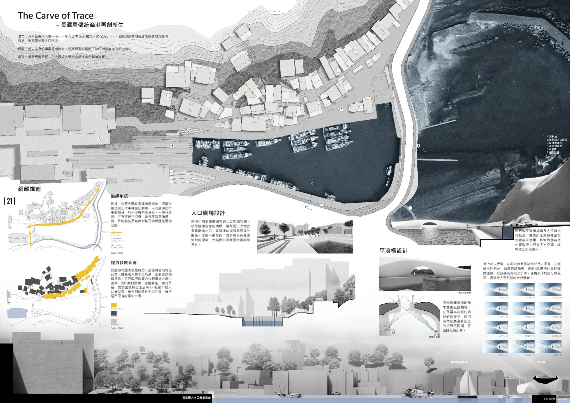
Paths are regraded so residents keep their working routes while visitors split off toward the harbour. The entrance plaza beside the museum’s historic building is opened up, restoring the power plant’s old water intake and reconnecting the museum to the sea and the village.
The breakwater bridge is reshaped so it no longer blocks the view to the Jiufen hills. After testing different angles and curves, a 60° concave edge deflects the wind upward and leaves a calm strip for people crossing. Shops and village experiences gather along the harbour front, while the homes behind keep their privacy.
Letting the sea back onto the rock.
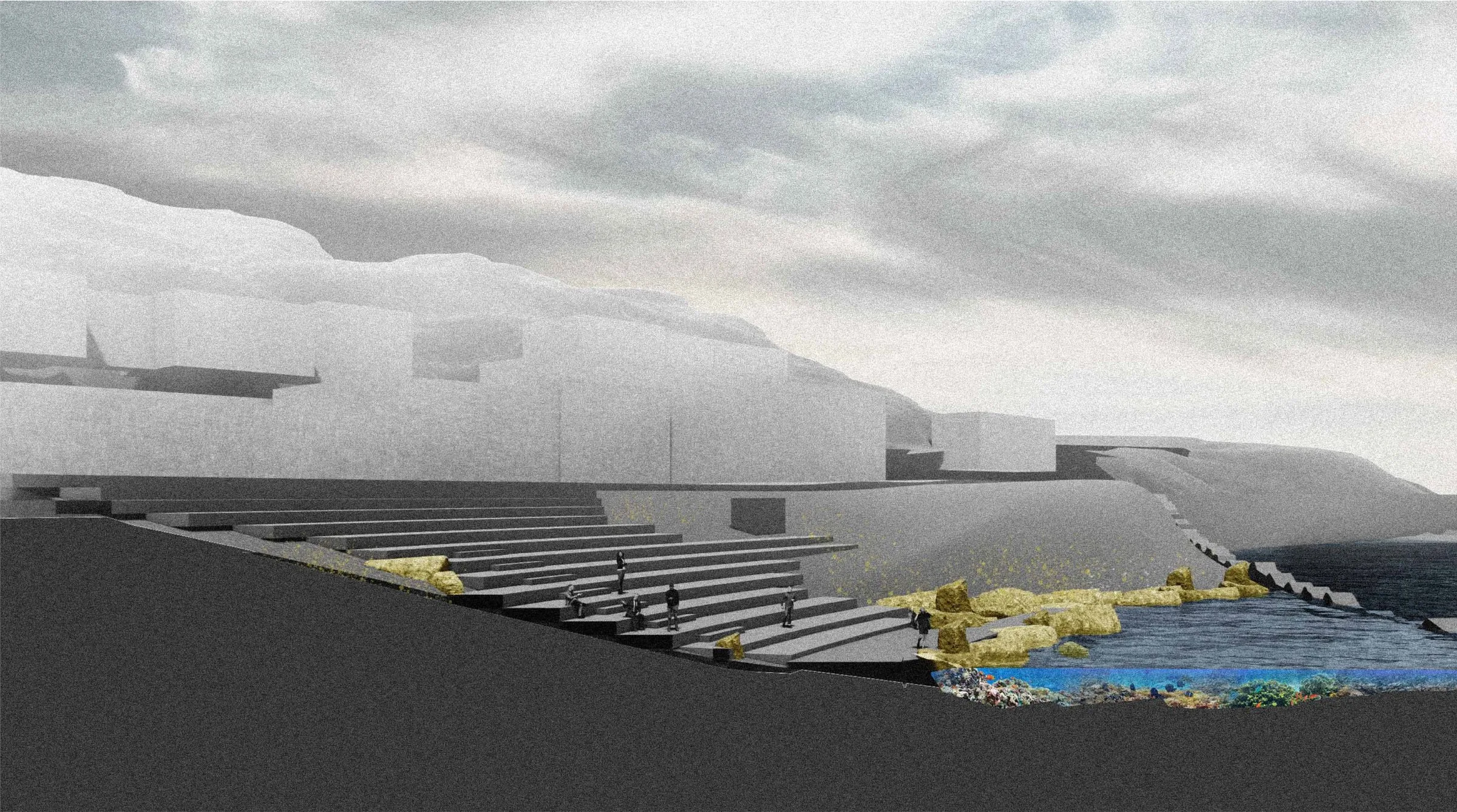
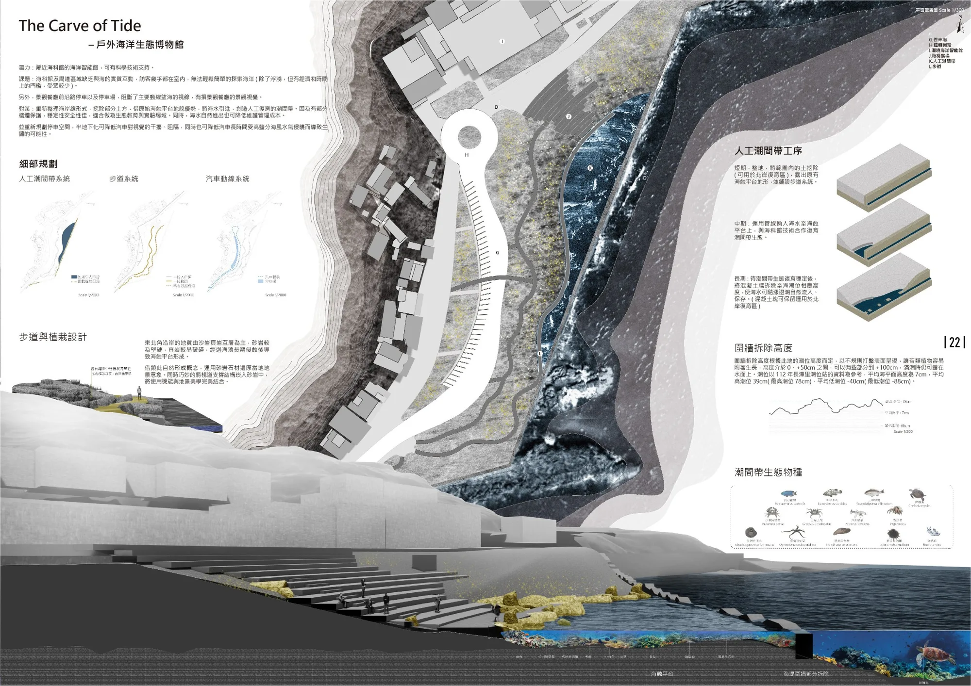
Visitors to the museum stay almost entirely indoors. Here, fill is removed to expose the original wave-cut platform and seawater is brought in to form a man-made intertidal zone. The remaining walls keep it safe for school groups, and the sea’s own movement keeps maintenance low. Parking moves half underground, out of the view and out of the salt wind.
- Short ExcavateRemove fill to expose the platform and lay the boardwalk. The soil goes to the north-shore restoration area.
- Mid Pipe in seawaterBring seawater onto the platform and restore intertidal life with the museum's science team.
- Long Lower the wallOnce the ecology is stable, cut the sea wall down to tidal heights so the tide floods and drains it on its own.
Wall heights follow the local tide record: mean sea level 7 cm, mean high water 39 cm (highest 78 cm), mean low water −40 cm (lowest −88 cm). The top is broken into heights between 0 and +50 cm, some at +100 cm, so parts stay above water even at high tide.
Shelter from the monsoon, aimed at the view.
The headland looks out to Heping Island, Keelung Islet, Keelung Mountain and Jiufen, but the sea wind kills almost everything planted here except ground cover, and wave erosion has undermined the old paths and stairs.
The earth-covered buildings take their layered profile from the exposed strata of nearby Qidou Mountain, and their lines point visitors toward the buried landmark hill. The wind walls borrow the curve of the native Taiwan lily. Their height and direction follow the views: the east wall turns toward Keelung Mountain at 45°, the south wall steers the eye to the Qidou cliffs. Of three profiles tested, a concave wall worked best, turning the northeast wind aside to leave sheltered pockets where coastal shrubs and lilies can take hold.