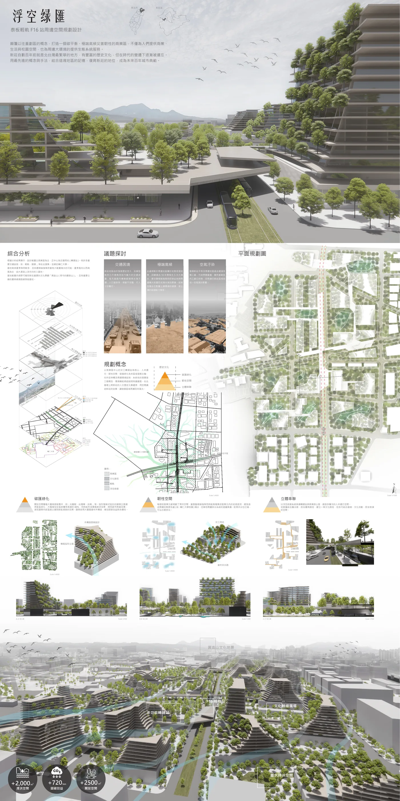
Floating Green Nexus
浮空綠匯——泰板輕軌 F16 站周邊空間規劃設計
A carbon-balanced, flood-ready district around a new light rail station, tied together by an elevated green corridor.
- Site
- Around Taishan–Banqiao Light Rail F16 station, Xinzhuang, New Taipei
- Year
- 2024
- Type
- Competition, Yang Light Rail Youth Design Competition
- Team
- Fu Jen Catholic University and National Taiwan University of Science and Technology
- Plans
- Master plan 1:1500, sections 1:500
- Award
- 3rd Place
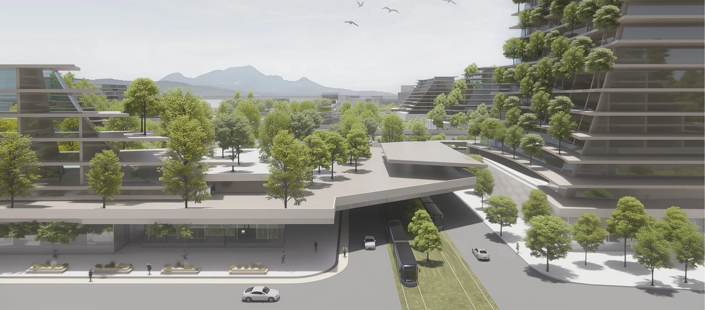
Taiwan's oldest boomtown, waiting for its next century.
Xinzhuang was the busiest town in northern Taiwan for centuries, but it has slowly faded from memory. The site is a redevelopment zone of former factories around F16, a stop on the new Taishan–Banqiao light rail line. Light rail, metro and a planned transfer station all meet here, and Fu Jen Catholic University sits right next door.
The site carries three problems:
Roads built for a historic town are jammed with cars and scooters every day, and the sidewalks are narrow and broken.
The area has flooded five times in ten years. Heavy rain turns it and the Fu Jen campus into a lake, and standing water degrades the soil's ability to store carbon.
The plain was once covered in factories. Those inside the zone are gone, but the industry around it still affects the air.
Carbon, resilience, connection, and the town's own history.
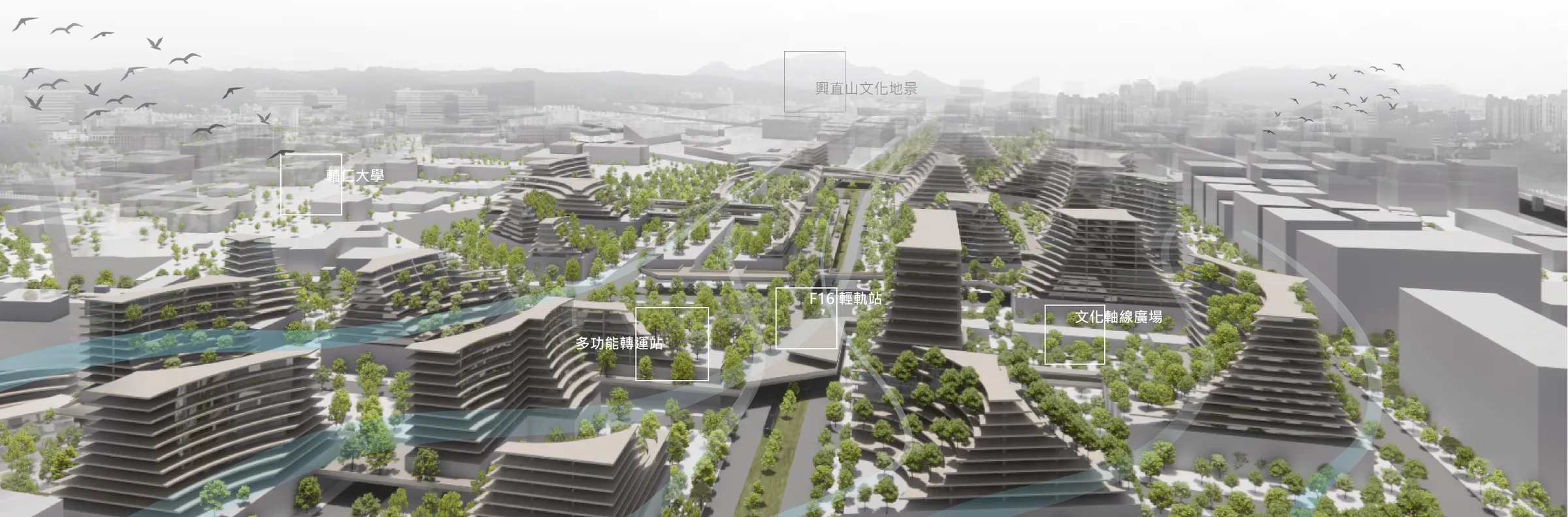
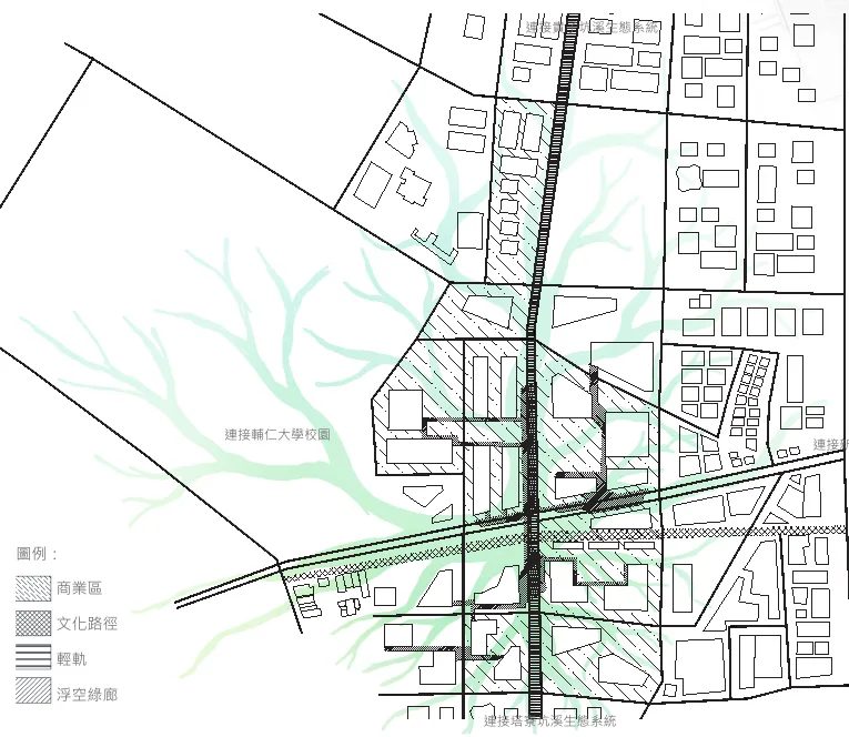
The plan takes the transfer station at the centre of the commercial district as its core and develops three systems outward from it: carbon-sink planting, resilient space and a layered pedestrian network. These reach out to the creeks and the university around the site. On top of them, the design brings Xinzhuang’s history back into the streets, so the district tells the town’s story again.
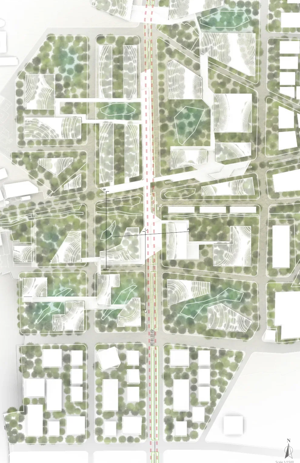
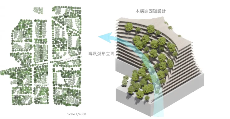
A district covered in trees, built in timber.
Open space is planted with high-carbon-storage trees such as Griffith’s ash, Taiwan zelkova and Taiwan incense cedar. The buildings step back in curved terraces covered in planting, which raises green cover to about 80% across the district. The curved facades also steer the summer southwesterly wind through the blocks, lowering the urban heat island and cooling the buildings inside. The structures use domestic timber to lock away more carbon.
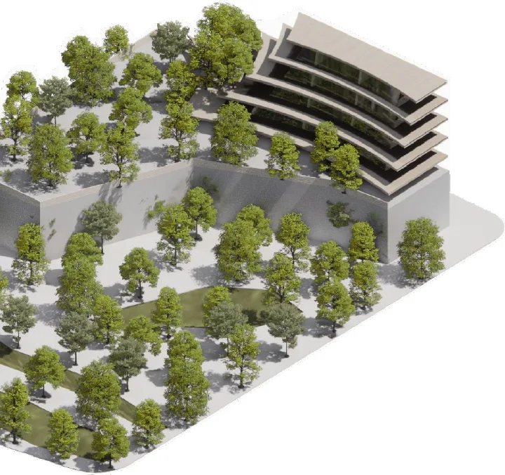
Every block holds its own rain.
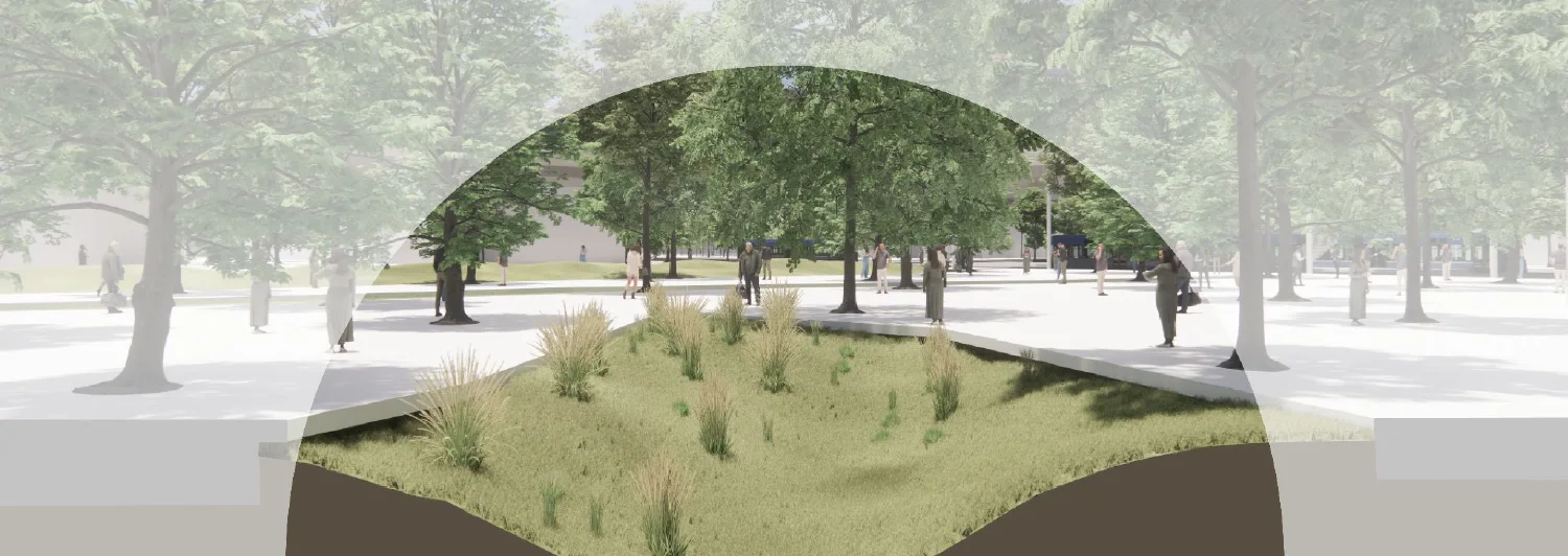
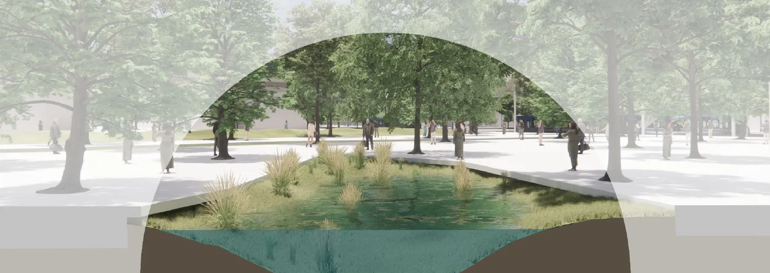
Each block has its own detention space. In a heavy storm it collects the block’s surface runoff so water no longer drains onto lower ground nearby, such as the Fu Jen campus, and the drainage system downstream is not overwhelmed. Stored water can be filtered and reused by the buildings. When the basin is full, the overflow drains out along the restored Houcun irrigation channel.
- Dry weatherA sunken lawn and meadow for rest, play and small wildlife
- Heavy rainThe same basin fills, holding runoff on site
- OverflowReleased along the Houcun irrigation channel
- SoilConstruction waste is reused as drainage layers so roots stay healthy and the soil keeps storing carbon
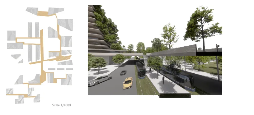
A floating green corridor above the street.
An elevated green corridor links the transfer station with the commercial core, creating a pedestrian network on several levels that is separate from traffic. On the ground, a cultural path follows the old irrigation channel and the route of the local temple procession, with space for festivals, folk performances and the procession itself. Its plaza looks out to Xingzhi Mountain, today’s Guanyin Mountain, a landmark long tied to Xinzhuang’s identity.
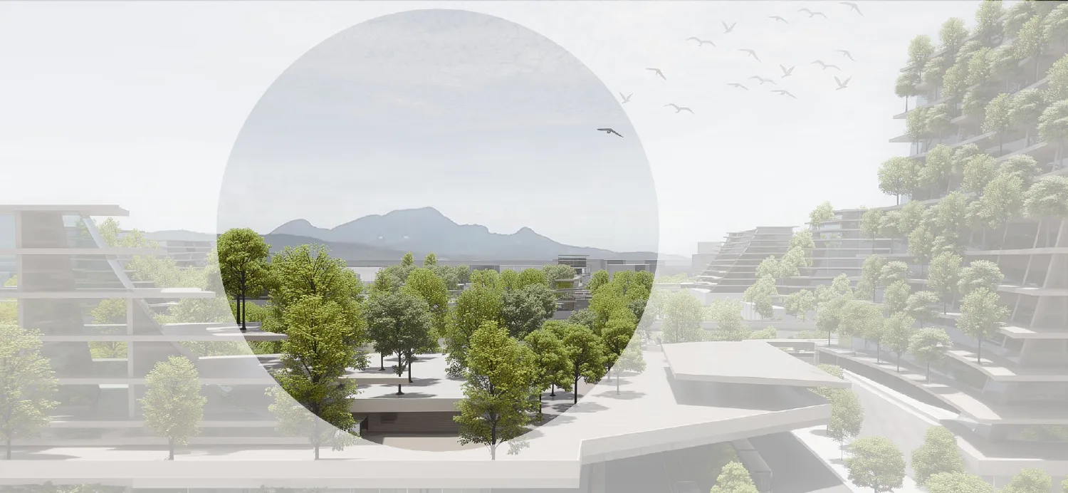

Sections A–A′, B–B′ and C–C′, 1:500