Reconnecting Urban Memory
城市記憶的再連結:可及性與文化傳承
Accessibility and cultural continuity. A walkway, a wildlife passage and a flood basin bring back the lost route between the Grand Hotel, Jiantan Mountain and the Keelung River.
- Site
- 823 Artillery Battle Memorial Park, Zhongshan District, Taipei
- Year
- 2024
- Type
- Team project
- Team
- Cheng-Ju Hsieh, Sheng-En Tsai
- Walkway
- About 250 m, slopes 1:12 to 1:15
- Scale
- Site plan 1:200
A forgotten path to the Grand Hotel.
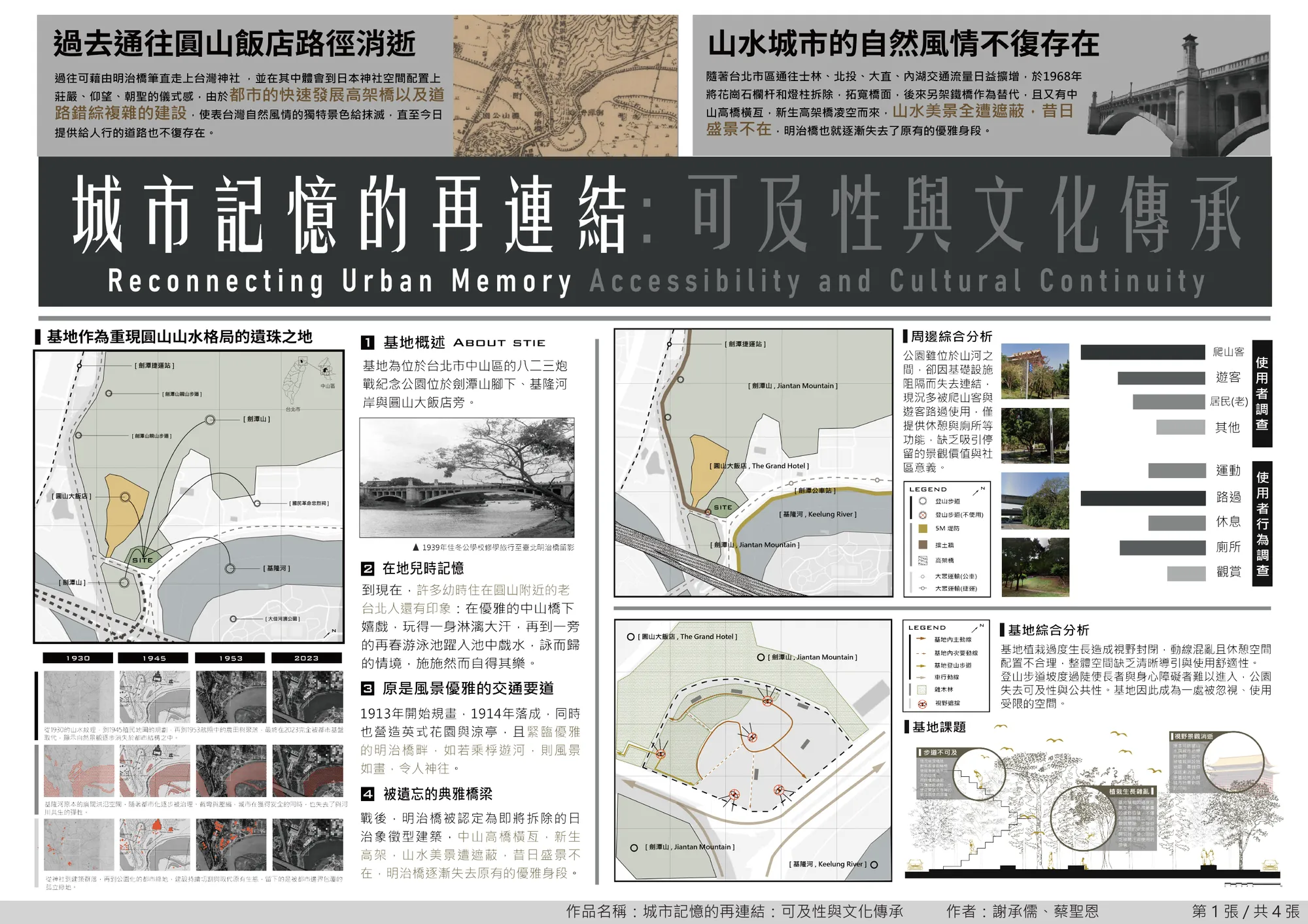
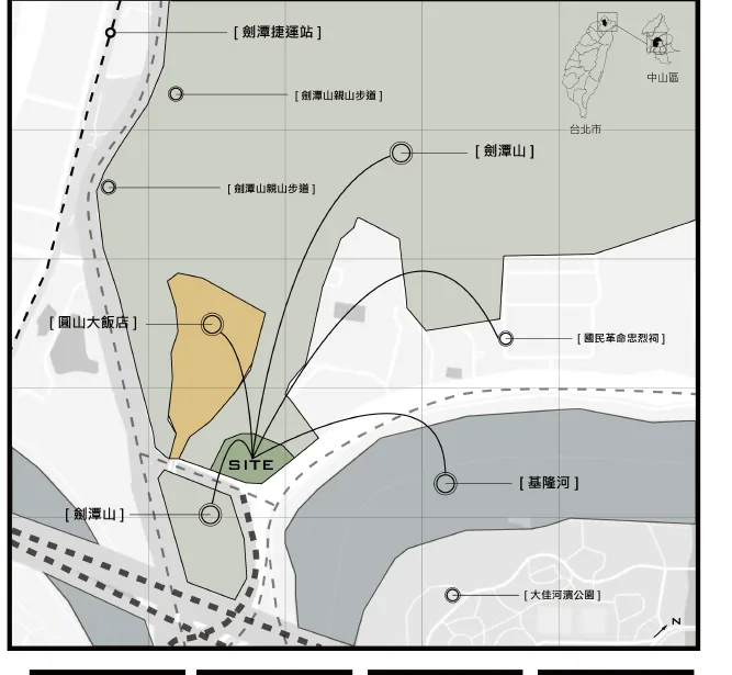
The site is the 823 Artillery Battle Memorial Park in Taipei’s Zhongshan District, at the foot of Jiantan Mountain, on the Keelung River and beside the Grand Hotel.
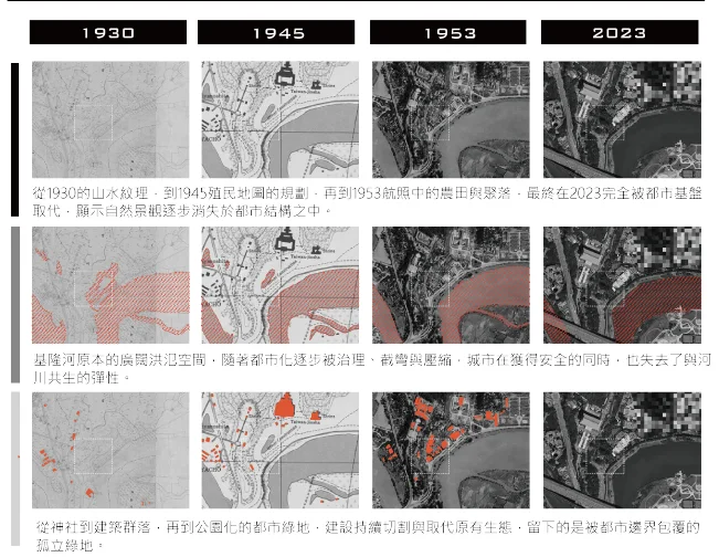
People once walked straight from the Meiji Bridge up to the Taiwan Shrine on the hill, and the approach was laid out to feel solemn and ceremonial. As the city grew, elevated roads and a tangle of new streets erased that landscape, and today no walking route to the hotel survives. The bridge itself, finished in 1914 beside an English-style garden, was once one of the most scenic crossings in Taipei. Older residents still remember playing under it and swimming in the pool nearby. After the war it was marked for demolition. From 1968 its stone balustrades and lamp posts were removed and it was widened, and the Zhongshan Expressway and Xinsheng viaduct were later built overhead, blocking the views of mountain and river that once defined the place.
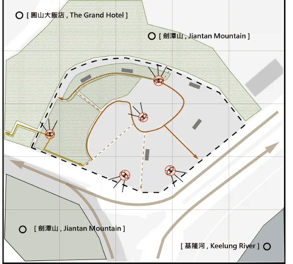
Bring back Taipei's city of mountains and water.
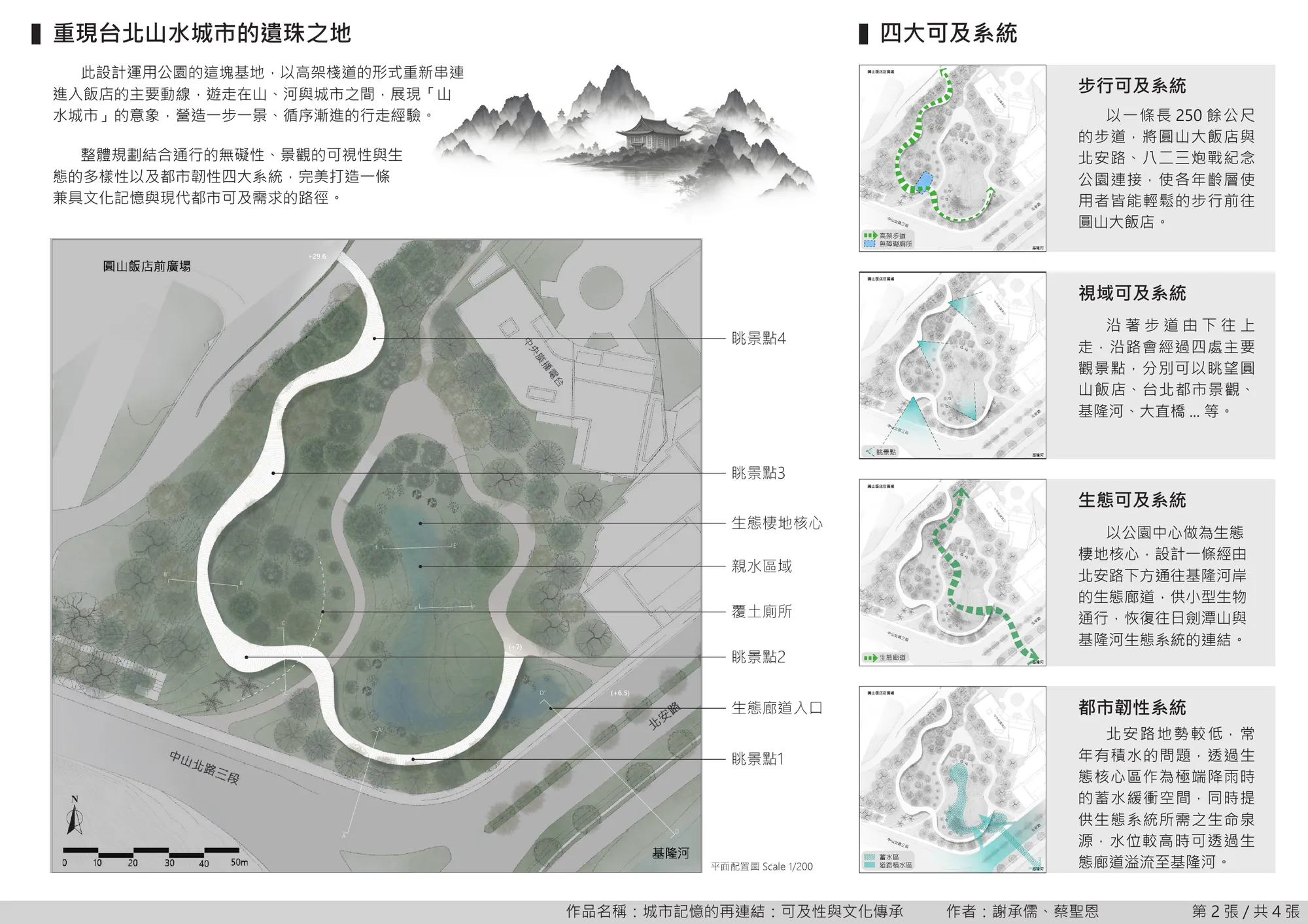
An elevated walkway through the park reconnects the main approach to the hotel. Walking between mountain, river and city, visitors see a new view at each step, recovering the old idea of Taipei as a “shanshui” city of mountains and water. The design combines four systems: walking access, visual access, ecological access and urban resilience.
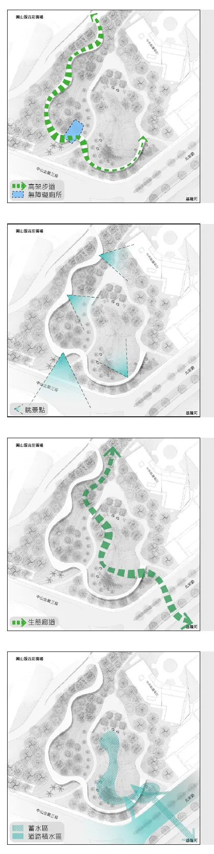
- Walking accessA walkway of about 250 metres links the Grand Hotel with Bei'an Road and the memorial park, easy enough for visitors of every age.
- Visual accessFour viewpoints along the climb look out to the hotel, the Taipei skyline, the Keelung River and Dazhi Bridge.
- Ecological accessThe park's centre becomes a habitat core, joined by a passage under Bei'an Road to the riverbank for small wildlife.
- Urban resilienceBei'an Road sits low and often floods. The habitat core holds water in extreme rain and overflows to the river through the passage.
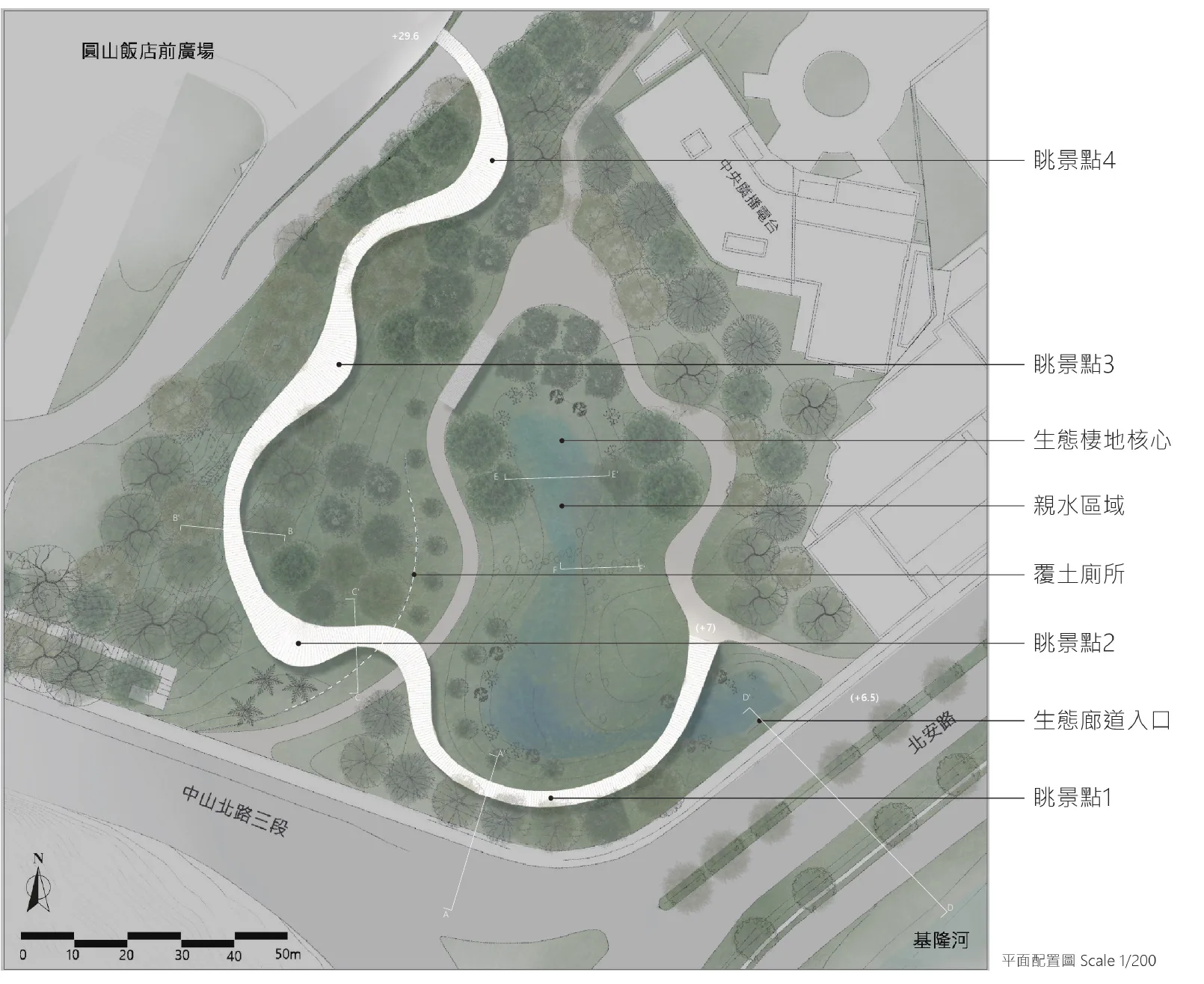
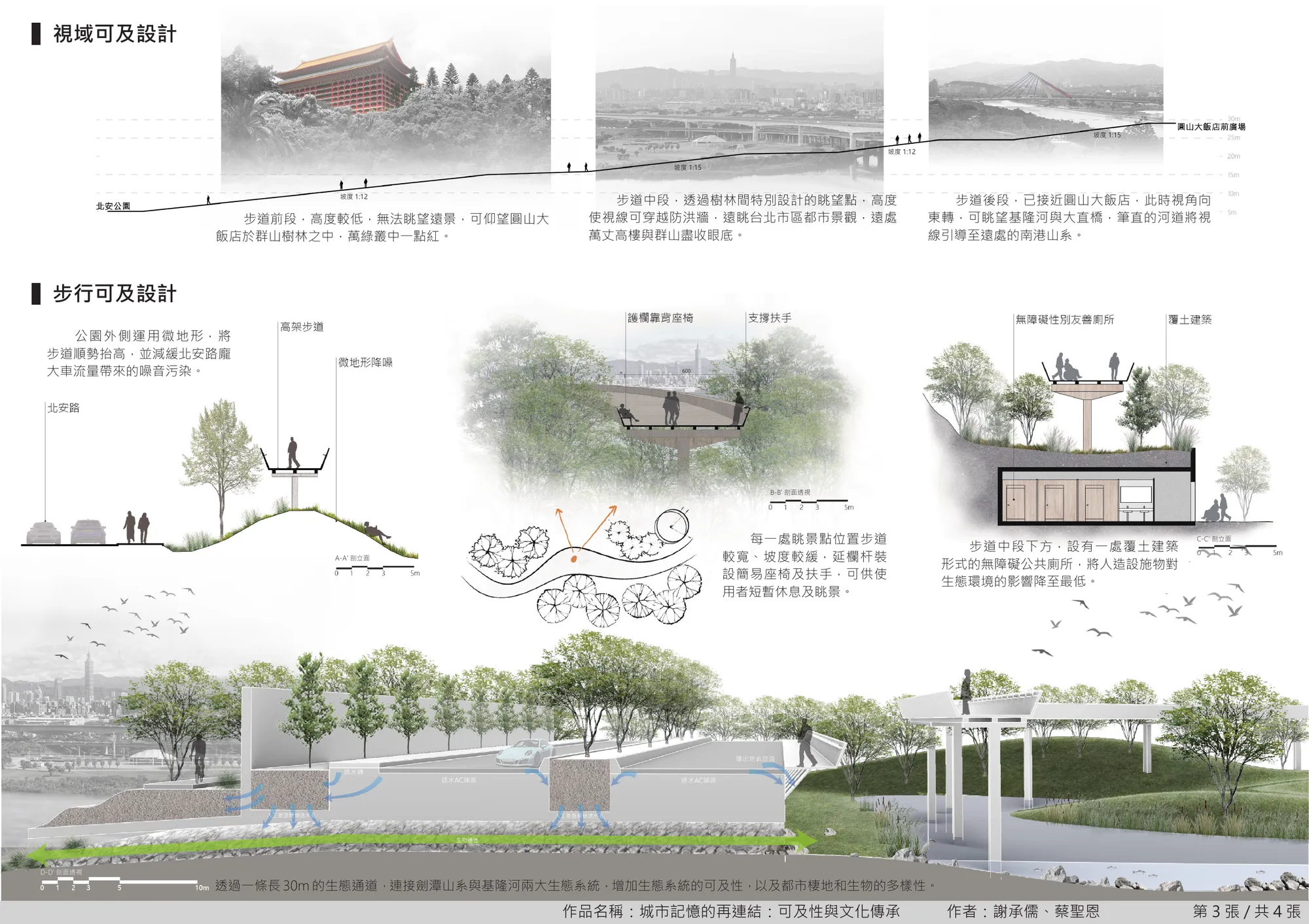
Three views on the way up.
- Start Looking upThe walkway is still low. Through the trees the red Grand Hotel appears high among the green hills.
- Middle Over the flood wallA lookout cut through the woods lifts the eye over the flood wall to the Taipei skyline and the mountains beyond.
- End Along the riverNear the hotel the view turns east, down the straight Keelung River and Dazhi Bridge toward the Nangang hills.

Walkway section with the view from each stage. Slopes 1:12 and 1:15.
Gentle, quiet and easy to rest on.
Along the park edge, small changes in ground level lift the walkway gradually and screen it from the heavy traffic noise on Bei’an Road. At each viewpoint the walkway widens and flattens, with simple seats and handrails along the railing so people can stop and take in the view. Under the middle of the walkway, an earth-covered accessible public toilet keeps built structures from intruding on the habitat.
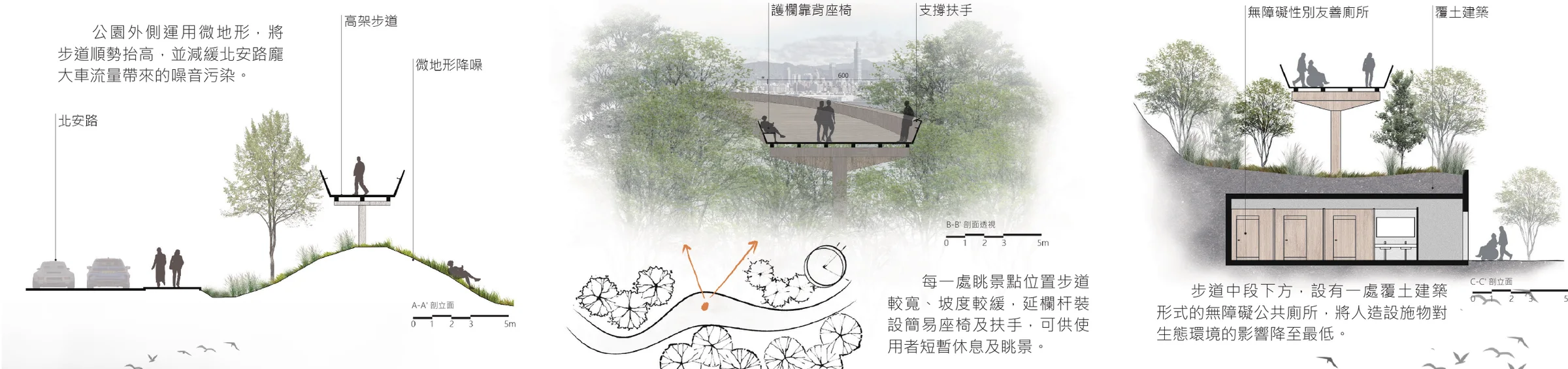
Sections A–A′, B–B′ and C–C′

Habitat from the hill to the water.
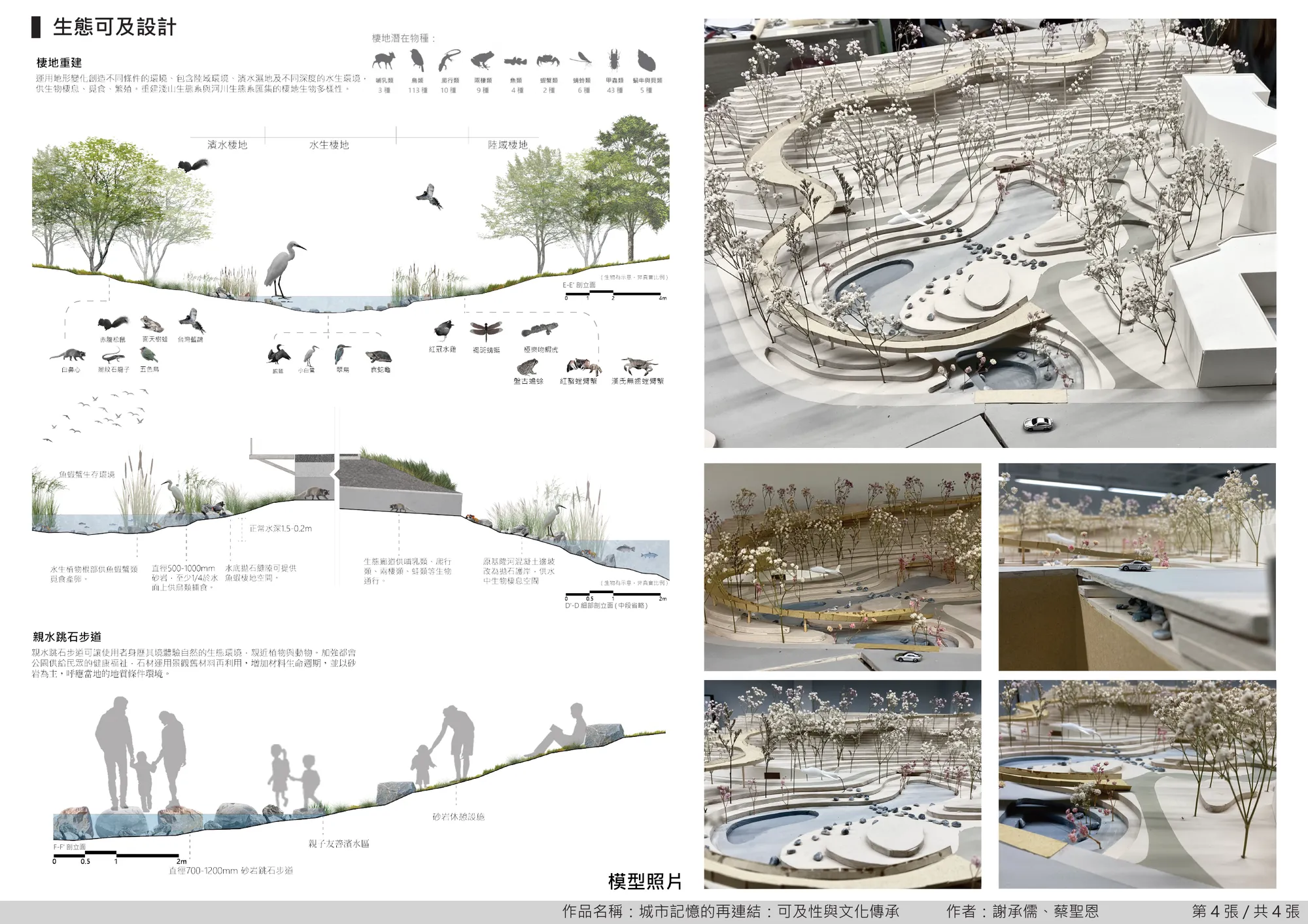
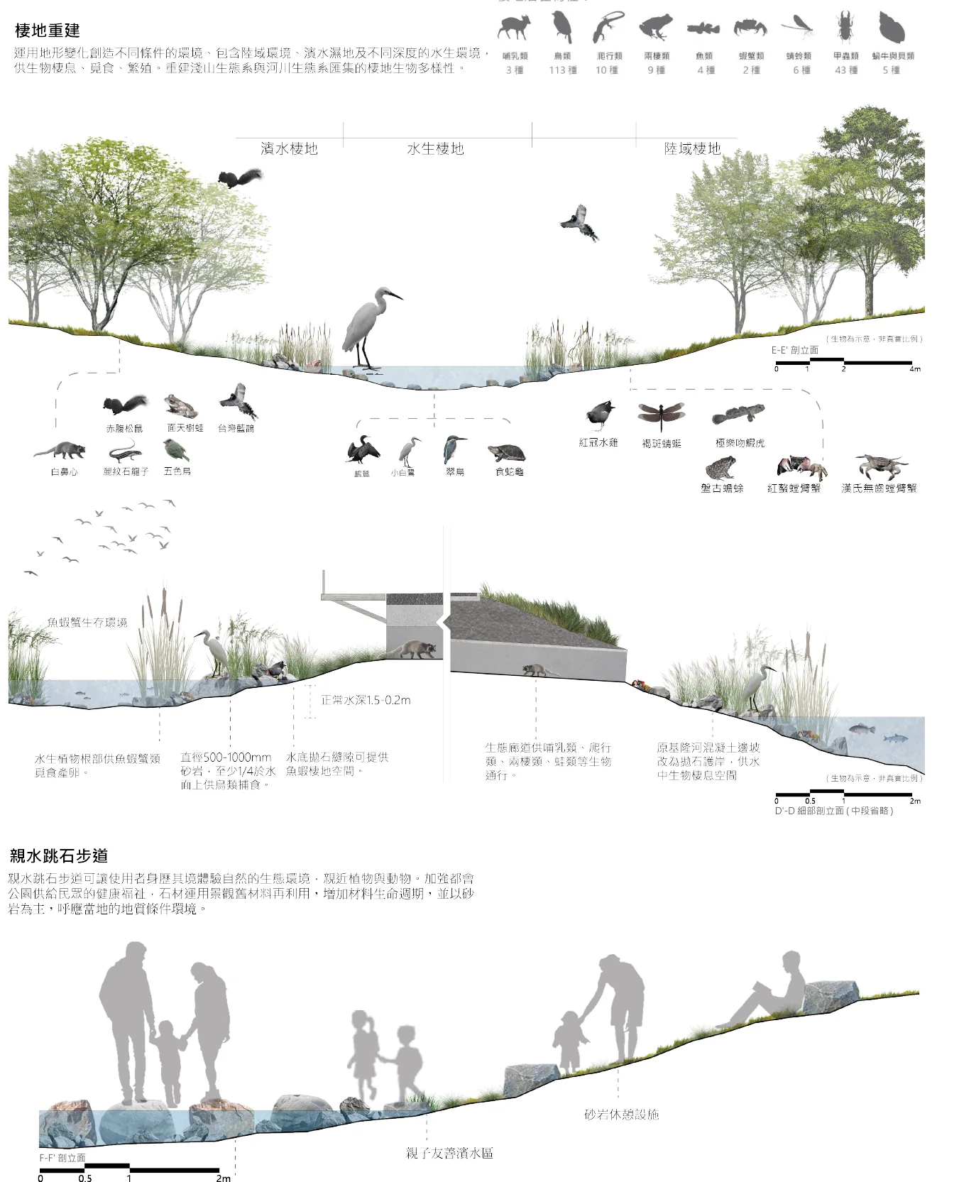
The 30-metre passage links the Jiantan Mountain and Keelung River ecosystems, widening the range of habitats in the city. Inside the park, ground shaped to different depths makes room for dry land, waterside wetland and open water, each with its own birds, amphibians, insects and fish. A sandstone stepping-stone path lets visitors walk into the wetland without disturbing it.
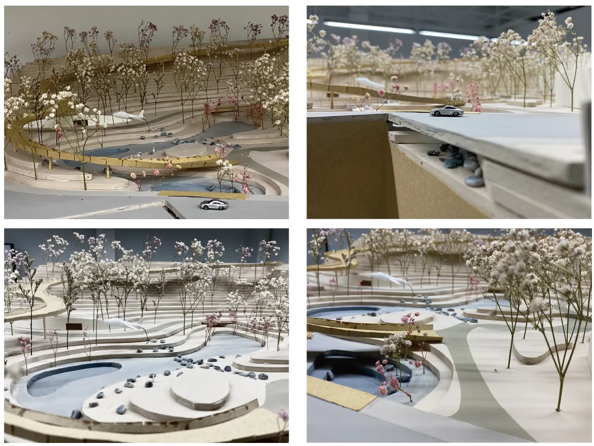
Testing the landform.
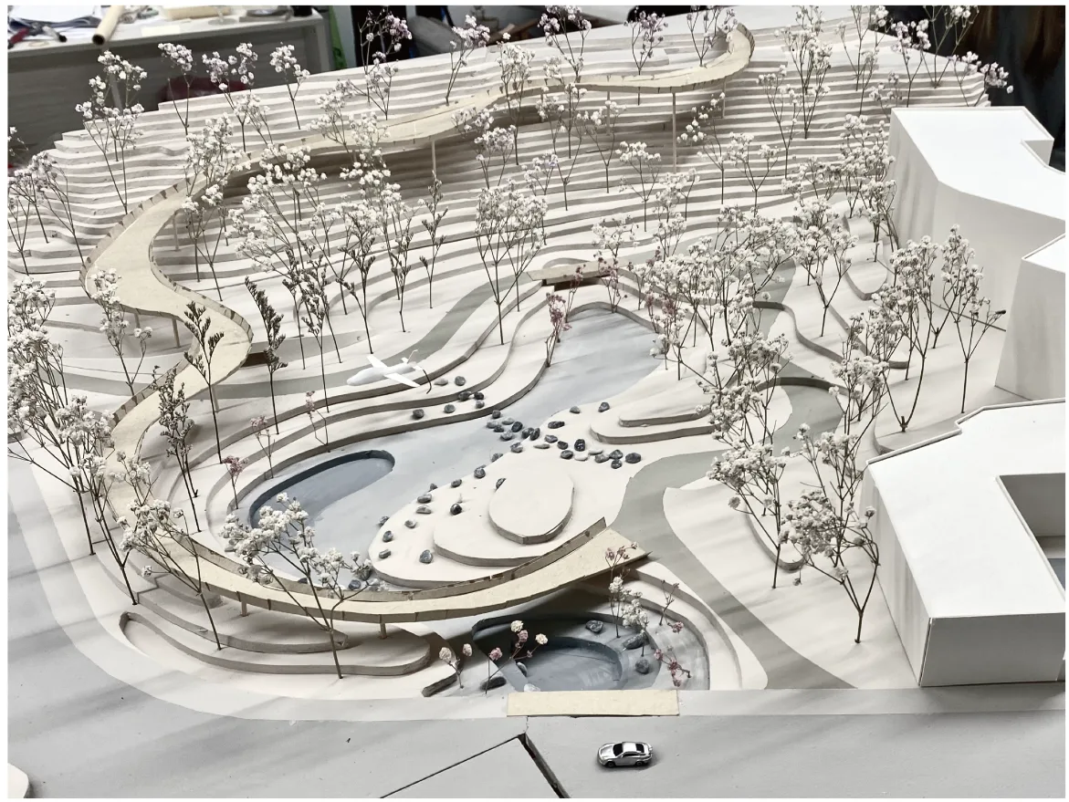
A physical model in card and wood tested how the walkway threads through the trees and how the sunken pools and terraces step down to the wetland.